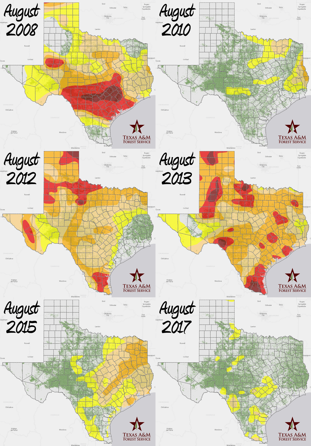
A Decade of August Drought Conditions
If you stop a Texan in the street and mention drought, you’re likely to hear some stories about 2011. While Texas is no stranger to drought — stop a seasoned Texan in the street and ask about the 1950s — it certainly became a hot topic in the years surrounding 2011. The 2011 drought was remarkable because it was both severe and widespread; its detrimental effects were dispersed across the entire state. Though the degree of impact varied regionally, trees in all areas of the state were affected by the drought. In total, 301 million trees in Texas forests died as a direct result of the 2011 drought or due to insect infestation or disease that took hold because of drought stress (see the drought assessment news release). Many others that were alive at the time of the survey were left weakened and susceptible to death by insects and disease.
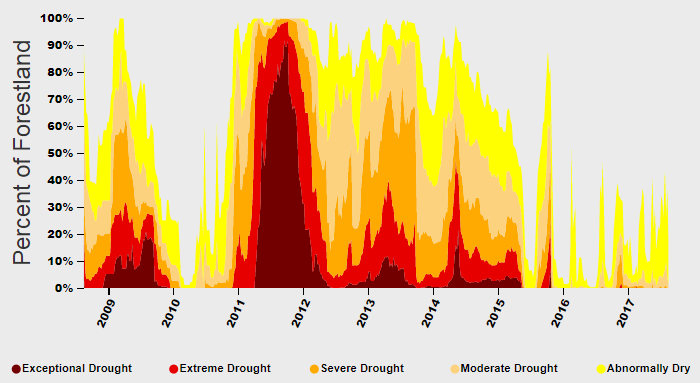
Because of the significance of the 2011 drought, we thought it would be interesting to look at the change in conditions over time from before the 2011 drought all the way to now. We chose to compare mid-August conditions over the past 10 years. Many of these years show significant portions of the state in drought conditions in August, but this year, at least, we see some relief. If you want to fill in the gaps and look at the whole trend instead of just August-to-August, check out this graph created with the Forest Drought application. It shows the percentage of the state’s forestland in drought conditions over time, from August 12, 2008 to August 15, 2017.

In this map, we wanted to highlight change, so we used an animated gif to show August drought conditions from year to year over the past 10 years. The drought colors are the standard U.S. Drought Monitor colors, with a Texas forestland map produced by Texas A&M Forest Service underneath. You can explore the data in Texas A&M Forest Service’s Forest Drought application.
The U.S. Drought Monitor is jointly produced by the National Drought Mitigation Center at the University of Nebraska-Lincoln, the United States Department of Agriculture, and the National Oceanic and Atmospheric Administration. Drought data courtesy of NDMC-UNL.
Join the conversation!
+ Contact
Rebekah ZehnderGeospatial Analyst
200 Technology Way, Suite 1281
College Station, TX 77845
979-458-6630 office
979-458-6633 fax
rzehnder@tfs.tamu.edu