Burn Bans and Drought
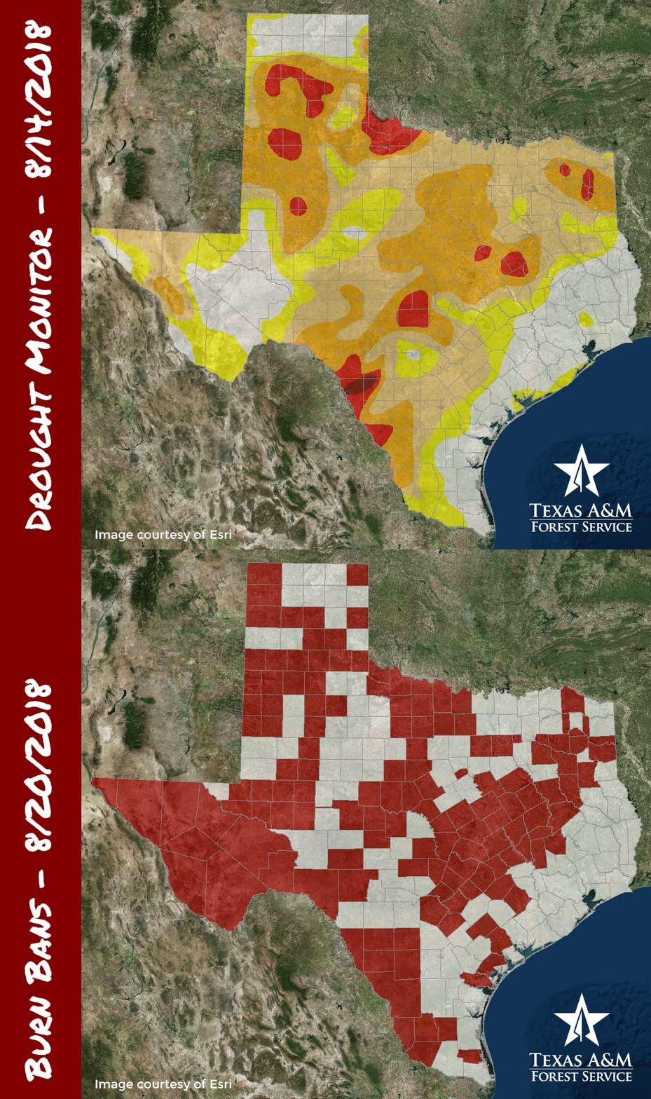
Burn bans, set by county judges and/or county commissioners’ courts, are an important preventative measure used to protect Texans from wildfires. When conditions are hot, dry, and windy, fires can spread very easily. Prohibiting outdoor burning helps mitigate that risk.
Drought conditions are one of several important factors county officials consider as they determine whether a burn ban is needed. The map above alternately shows current drought conditions and current burn ban status. Dryness progresses from Abnormally Dry (yellow) to Exceptional Drought (the darkest red). Animated GIFs are a great tool for showing comparisons without cluttering a map.
Texas A&M Forest produces a statewide burn map daily based on information received from the counties. Visit our burn bans page to see the current status. For up-to-date information on drought conditions, see our forest drought app.
Join the conversation!
+ Contact
Rebekah ZehnderGeospatial Analyst
200 Technology Way, Suite 1281
College Station, TX 77845
979-458-6630 office
979-458-6633 fax
rzehnder@tfs.tamu.edu