Writing a Burn Plan
A prescribed fire burn plan is required for each burn. The plan is prepared by qualified personnel conducting the burn and includes criteria for the conditions under which the fire will be conducted—a prescription.
Below leads you through each element of a prescribed burn plan with links to instructions and useful information when preparing and planning.
Burn plan templates:
Landowner and burn boss information
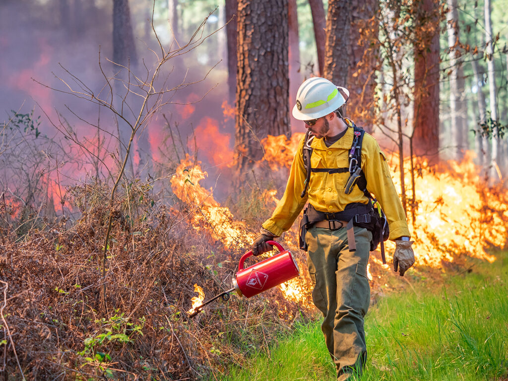
This section of the plan lists the names, contact information, and affiliation of the landowner and Burn Boss. The Burn Boss, also referred to as the Burn Manager, is the person responsible for the entire prescribed burn operation.
In Texas, anyone has the right to conduct a prescribed burn on their land or at the permission of another landowner, but the burn boss and the landowner are legally responsible for any damage caused by the fire itself or the smoke that is emitted.
The Texas Department of Agriculture’s Certified and Insured Prescribed Burn Manager Program removes liability from landowners and places it with the burn boss and their insurance company.
Find a burn manager
Find a certified and insured prescribed burn manager
Prescribed burn courses and continuing fire training courses
Burn site information
A prescribed fire burn plan provides information on the location of the property and the specific location of the treatment area. It generally includes the street address, 911 address, county, coordinates of entrance, coordinates of burn unit, and acreage.
Justification of prescribed burn
As part of Texas Commission on Environmental Quality rules and regulations on open burning, an activity is only considered a prescribed burn and therefore an authorized activity if it is for forest, range, wildland/wildlife management, or wildfire hazard mitigation purposes.
Burn area description
A prescribed fire burn plan describes the area to be burned. It outlines the size of the unit, fuels within the unit, and firebreaks to be used. It also lists the personnel and equipment needed to prepare the firebreaks, ignite the burn, and properly hold the burn within the firebreaks.
Burn unit interior description
The burn unit description describes the location and size of each fuel type/fuel model and their conditions. This requires mapping the fuels and on-site investigation of their characteristics. The conditions of the fuels required for the burn to take place are outlined in a different section called the prescription.
Firebreak description
The firebreak description is a section that provides the details of each of the firebreaks/fire guards that will keep the fire within the burn unit boundaries. This description also includes information on work require to establish or re-work these breaks prior to ignition.
Personnel and equipment
This section lists and describes the minimum personnel and equipment required to conduct the burn. It is usually broken up into jobs or sections like firebreak establishment, ignition, holding, and mop up. Other information like distance to water sources can also be included in this section.
Descriptive elements
These elements describe the time and conditions that must exist in order for the burn to occur. Season, dates, time of day.
Weather
This section outlines the window of weather conditions that must exist for the prescribed burn to take place. Preferred weather conditions may be included as well.
Determining the correct allowable weather conditions for a specific prescribed burn is a complicated balance between conditions required by law, conditions that allow fuels to ignite within the unit and successfully achieve management goals, and conditions that will minimize risk of an escape.
These weather conditions also play a role in what happens to the smoke produced by a prescribed fire, but the specific variables that influence smoke are usually outlined in a separate section called Smoke Management.
- Temperature minimum and maximum – above freezing to minimize preheating of vegetation and cool enough to prevent worker fatigue.
- Relative humidity minimum and maximum – maximum relative humidity that will support a successful burn varies based on fuel and region while minimum relative humidity for burning is based on safety as this influences fire behavior and potential for spot fires.
- Surface (20 foot) wind speed minimum and maximum – allowable surface wind speeds are listed in TCEQ rules for outdoor burning and must be between 6* mph and 23 mph (5* mph on the low end for TDA CIPBM).
- Mid-flame wind speed minimum and maximum – a calculated value that varies based on vegetation, but this value helps burn managers better predict fire behavior and is often listed along with surface wind.
- Surface wind direction(s) – wind directions are set by the burn manager to minimize risk of an escape fire and based on smoke management concerns, including TCEQ rules of sensitive structures.
- Transport wind speed – effects smoke dispersion as well as if and how smoke will travel.
- Transport wind direction(s) – effects direction smoke will travel.
- Mixing height (minimum) – the mixing height is the maximum elevation that rapid vertical mixing occurs in the atmosphere. It determines how high smoke will travel and is influenced by the stability of the atmospheric conditions. Instability in the atmosphere supports increased fire behavior.
- Category day – is a numeric value from 1 to 5 that indicates the vent rate as derived from the Ventilation Index System. Its value takes into account mixing height and transport wind making it a reliable predictor of smoke dispersion.
Complex factors are involved in determining the proper weather conditions for conducting a prescribed burn:
Fire behavior
This section provides a description of the fire behavior that is expected based on the conditions outlined in the prescription. Values are provided as the minimum and maximum fire behavior that can be expected given that the prescription allows for a window of potential environmental conditions.
- Flame length – the length of the flames from the tip of the flame to the midpoint of the flame footprint. This value helps anticipate fire effects and appropriate design of firebreaks.
- Rate of spread – rate of spread is a measure of the distance a fire will travel over time. It is controlled by the fuel model, fuel moisture, and weather conditions.
- Fireline intensity – the heat energy released by a flaming front. Expressed as BTU per second per foot.
Determining fire behavior: these resources are helpful in determining fire behavior and how it pertains to planning a successful prescribed burn. Values are usually derived from the tables in the Fireline Handbook’s appendix B or using the software BehavePlus.
Adjacent units
This section allows burn managers to provide a description of areas that are adjacent to the burn unit. The characteristics of adjacent units is important information to have if a spot outside the firebreaks occurs.
- Description of units that border to the north, south, east, west, and other. This section describes the size and general characteristics of the units adjacent and near the burn unit.
- Fuel types or models. It is important to identify the vegetation that exists by categorizing the fuel model that most closely matches it and then describing the characteristics of that fuel model that will exist on the day of the burn.
- Fuel load and distribution. Fuel load is the measurement of the biomass on a given unit of land. Often measured in tons per acre, it helps predict the vegetation that will be consumed. It influences fire behavior and the smoke that is produced.
- Fuel moisture minimum and maximum. Fuel moisture influences the vegetation that is available for a fire to consume and therefore directly affects fire behavior.
- Structures, utilities, oil and gas infrastructure, fencing, livestock, wildlife, threatened and endangered species. Identifying the structures (environmental and man-made) that are in the area surrounding the burn unit is important planning and decision making.
Planning narratives
A written narrative for each part of the burn operation is essential to communicating with personnel, being able to implement the burn as planned, and as a record if things do not turn out as planned.
- Test fire plan. The test fire plan explains the specifics of how and where the burn manager plans to start an initial test fire on the day of the burn to verify that conditions and fire behavior match the prescription from the burn plan.
- Ignition plan. The ignition plan outlines the method(s) the ignition team will take to ignite the vegetation based on environmental conditions and the desired fire behavior outlined in the prescription.
- Holding plan. The holding plan explains the personnel and equipment assignments that will be tasked with holding the fire within the burn unit boundaries.
- Mop up plan. The mop up plan explains the plan for activities following the ignition phase, standards to be used when extinguishing fire or heat that remains after the active fire, and patrols that are needed following the burn operation.
- Emergency medical plan. The medical plan identifies the closest medical treatment facilities, methods to communicate a medical emergency, and locations for ambulance and helicopter access.
Escape fire or contingency plan
The contingency plan outlines the steps that will be taken in the event of an escaped fire by the burn manager, personnel working at the burn unit, and additional equipment and personnel available. This plan should include trigger points for requesting assistance privately and notifying emergency dispatchers or 911.
Smoke management
Smoke management practices limit impacts on air quality and smoke sensitive areas before, during, and after burning. Surface (20 foot) wind speed minimum and maximum. Allowable surface wind speeds are listed in TCEQ rules for outdoor burning and must be between 6* mph and 23 mph (5* mph on the low end for TDA CIPBM).
- Surface wind direction(s). Wind directions are set by the burn manager to minimize risk of an escape fire and based on smoke management concerns, including TCEQ rules of sensitive structures.
- Transport wind speed. Effects smoke dispersion as well as if and how smoke will travel.
- Transport wind direction(s). Effects direction smoke will travel.
- Mixing height (minimum). The mixing height is the maximum elevation that rapid vertical mixing occurs in the atmosphere. It determines how high smoke will travel and is influenced by the stability of the atmospheric conditions. Instability in the atmosphere supports increased fire behavior.
- Category day. Is a numeric value from one to five that indicates the vent rate as derived from the Ventilation Index System. Its value takes into account mixing height and transport wind making it a reliable predictor of smoke dispersion.
- Potential impacted areas. Our Smoke Management Plan explains methods and applications for projecting smoke from a prescribed fire. The free mapping applications below can provide the chance to create custom maps of potential impacted areas.
- Smoke sensitive areas. Identifying the specific locations and structures that should not be impacted by smoke is an important step in determining the weather variables that will be allowable in the prescription.
- Mitigation actions to be taken. These actions may include burning only within certain environmental parameters, ignition methods, mop up methods, and moving occupants to another location.
- Smoke management notifications. A list of sensitive receptors and contact info can be used to warn and mitigate the impacts of smoke on others. These notations are usually listed separately from the notifications of public officials that occur on the day of the burn.
Notifications
Notifications must be made prior to burning and should be written in the burn plan to ensure all the contact information is available and used on the day of the burn.
Notifications could also be made to:
Maps
Various maps are useful in planning and implementing a prescribed burn, but a location map, burn unit map, and smoke management map or considered essential elements of a prescribed burn plan. Use these tools to create maps for your burn plan:
Go/no-go checklist
A GO/NO-GO Checklist is filled out on the day of the burn prior to ignition of the main burn unit. This document is a final checklist to ensure all planning and pre-fire actions have been taken and that current conditions are within the prescription on the prescribed burn plan.
Various Go/No-Go checklists are available and often are specific to the organization that employs the burn manager.