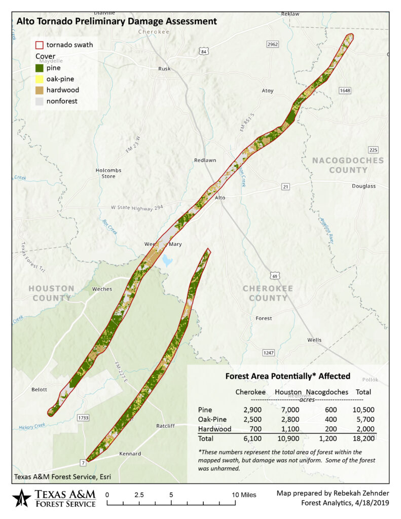
To get a preliminary idea of the possible extent of damage to forest resources in the area, we intersected the path of the tornado with our forest-type map. Not all of the area within the path was damaged, so these estimates represent an upper limit on the affected area. A significant portion of the tornado’s path was through Davy Crockett National Forest, so we broke the estimates out by public and private ownership. As many as 18,200 acres of forest may have been affected by the tornado, with about 5,500 of that occurring on publicly-owned land and 12,700 on privately owned land.
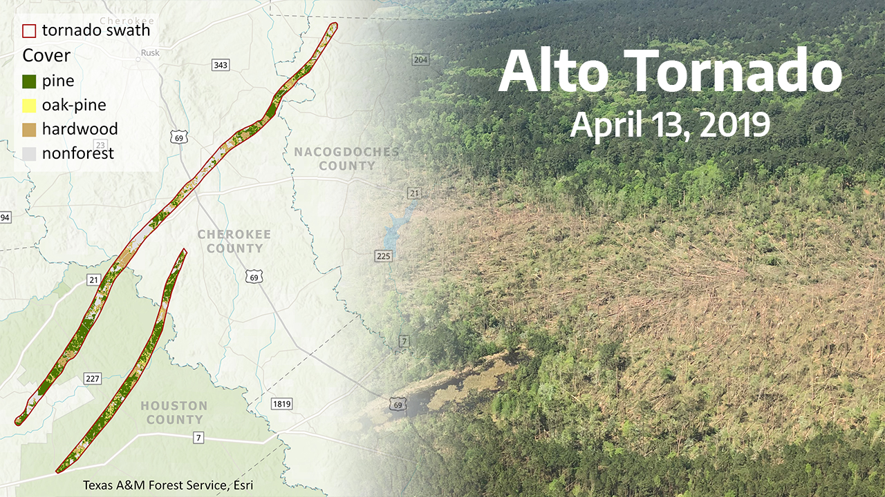
Since the tornado path crossed three counties, we also broke out the acreages by county.

The tornado path was mapped from the air with ArcGIS Collector. The forest type map was derived from Forest Inventory and Analysis data in conjunction with a suite of mapped environmental variables. Analysis and maps were completed in ArcGIS Pro.
.