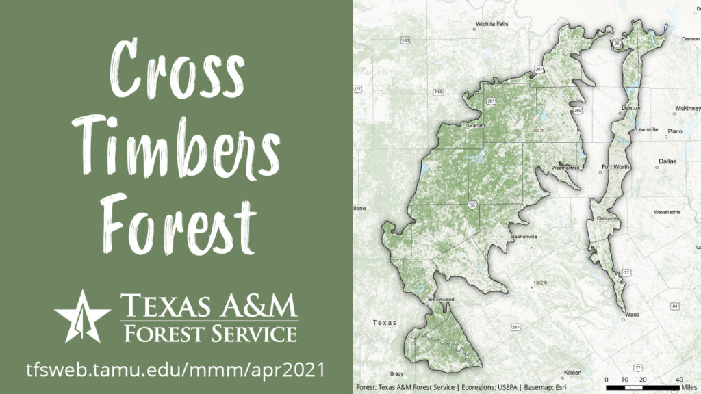
The east and west cross timbers comprise important ecoregions in north Texas. This map shows forestland in those ecoregions. The forestland was mapped from Forest Inventory and Analysis data and a suite of environmental variables. You can read more about it here. The ecoregions are EPA Level IV ecoregions, and you can learn more about them here. I made this map using ArcGIS Pro and Adobe Illustrator.