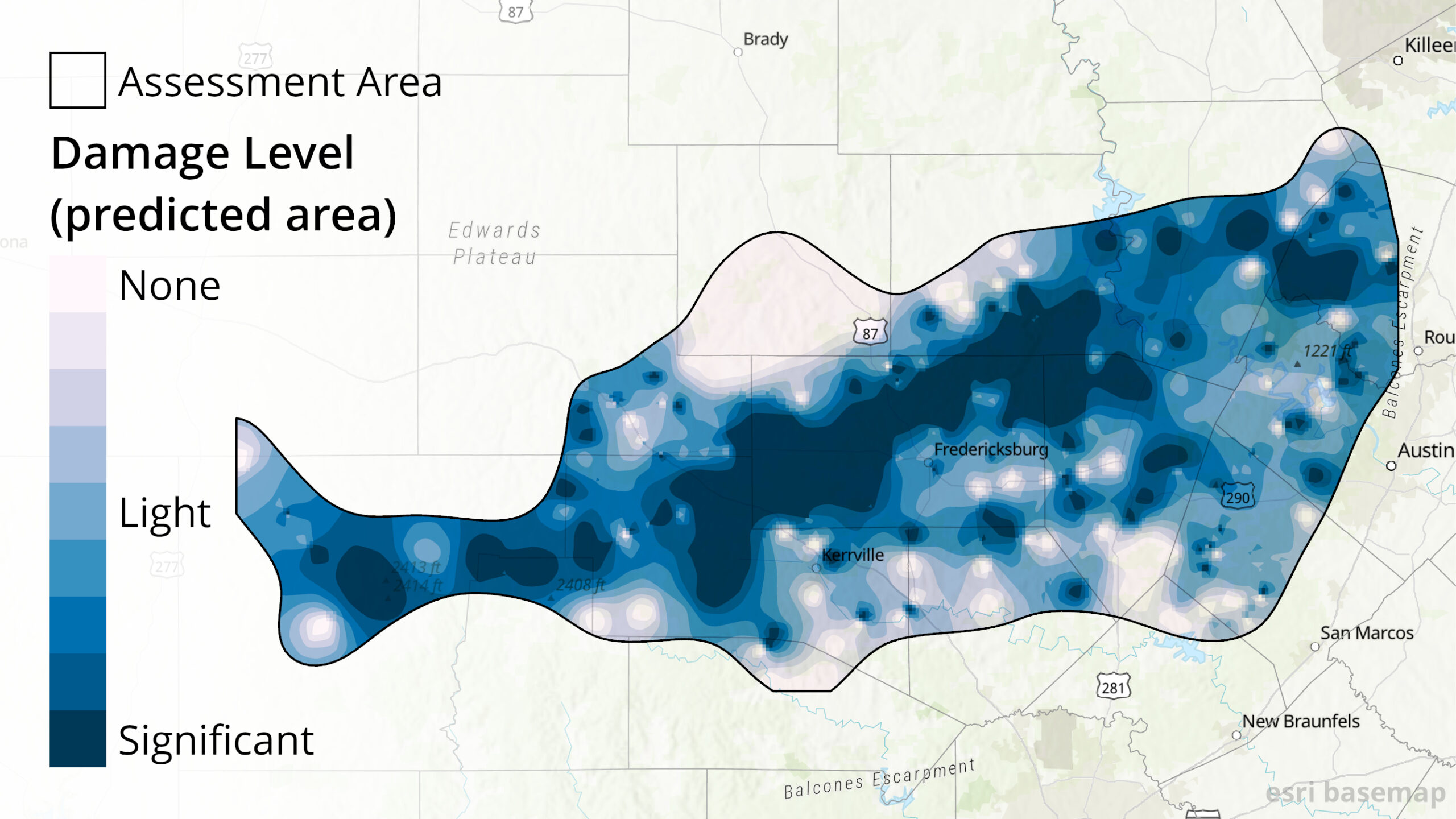
In February, Texas experienced historic winter storms. Our Central Texas staff performed roadside assessments of tree damage following the ice events that occurred in their area on February 11th and February 17th. ArcGIS Collector was used for the data collection, with an ArcGIS Online viewer for managers to see the data (including photos) being collected in real-time. Staff recorded three damage levels: none (no visible damage to trees), light (small limbs/branches down), and significant (major breakage). This information was used to create an interpolated map of expected damage across the assessment area. Essentially, we used the observed points to fill in the gaps between observations since it would be impractical to observe the entire area. To do this, I used an inverse distance weighting technique in ArcGIS Pro. These maps are available in one document here. The predicted area gives a quick visual of where damage was concentrated, but the points are also included for reference because the damaged areas are generally more reliable where more points were collected. Please note that this particular assessment focused on the area west of Interstate 35 in Central Texas, but trees in other parts of the state also experienced damage. If your trees were damaged and you are in need of assistance — whether in Central Texas or another area of Texas — please check out our After the Storm page or contact your local Texas A&M Forest Service representative.