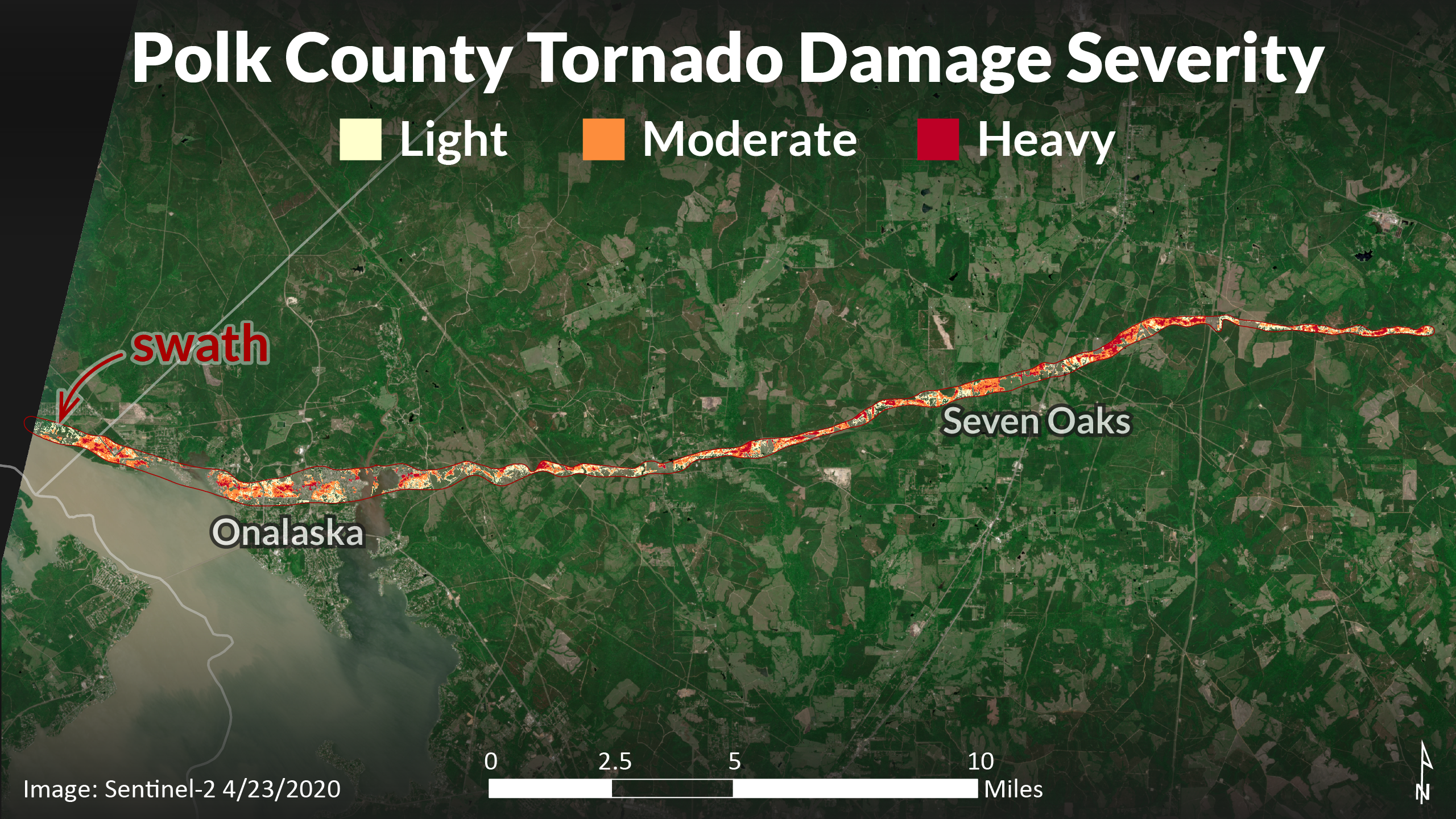
A tornado touched down in Polk County on April 22, 2020, in the area of Onalaska and Seven Oaks. We conducted a rapid damage assessment to estimate the amount of timber damaged by the storm.

One of our foresters mapped the approximate boundary of the tornado’s path from a DPS helicopter. He also photographed much of the damage and estimated percentages of downed timber.
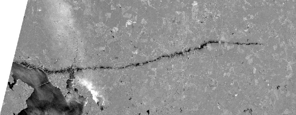
I obtained Sentinel-2 Level-2A images acquired before (April 16) and after (April 23) the tornado struck. I calculated a Normalized Difference Vegetation Index (NDVI) on each of the images, which essentially gives an indication of how “green” each pixel is. I then took the difference between the NDVI before and after the tornado. Large decreases in NDVI correspond to heavy destruction, while smaller decreases correspond to less damage. Here’s what that looks like:

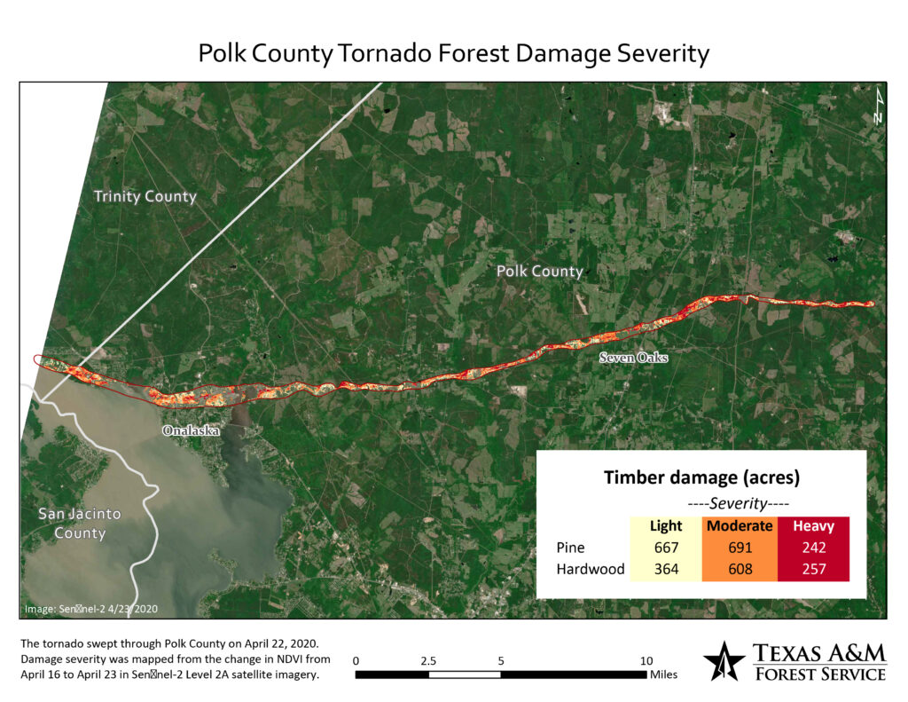
The darker the pixel is, the greater the decrease in NDVI and the greater the vegetation loss. The track of the tornado is very stark. Note that waterbodies appear dark as well. The bright white is smoke from a fire in the April 16 image. We are interested particularly in damage to timber, so we masked out everything other than forest in the image to focus just on forestland. Using the photos and descriptions from the helicopter flight, I determined where to draw the line between the severity classes.
Once I had the severity classes mapped, I tabulated the area of each of them by forest type. These acreages formed the basis for the damage assessment. You can read the whole assessment here.

Sentinel-2 imagery was downloaded from https://scihub.copernicus.eu/dhus on April 24, 2020.