Bastrop is no stranger to the devastation that wildfire can bring to a community. Eight years ago, Bastrop witnessed the most devastating wildfires in the history of Texas. The Bastrop County Complex wildfire covered 32,400 acres, of which 75 percent saw extreme fire intensity levels. 1,660 homes and 36 commercial buildings were destroyed and the fire burned for 37 days. Once the wildfire season subsided, Texas A&M Forest Service didn’t go home. Several agencies including Texas A&M Forest Service have been restoring the unique Lost Pines ecosystem.

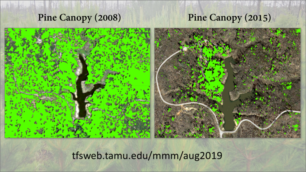
The image shows the pine canopy mapped in 2008 and 2015 for a small area surrounding Bastrop State Park Lake. Visit our app that combines interactive maps with compelling multimedia content to tell the story of Bastrop wildfire, restoration and more.