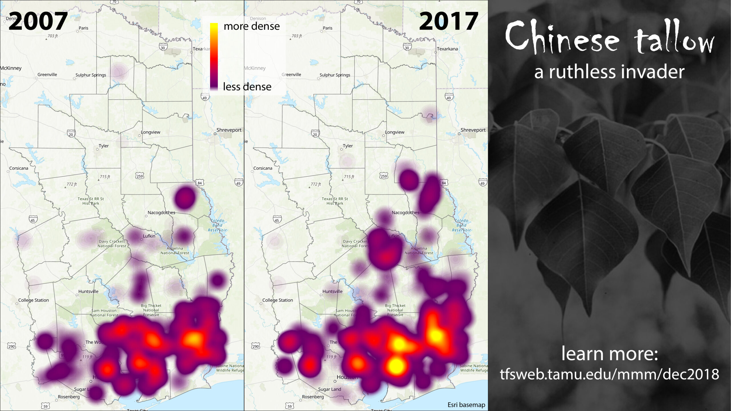
Chinese tallow is an invasive species spreading through Texas forests. It threatens our ecosystems by outcompeting native vegetation, degrading soil conditions, and negatively impacting wildlife. Its leaves and fruit are literally toxic!
An important part of managing an invasive species is knowing where it is occurring and how its distribution is changing over time. Through Forest Inventory and Analysis, we have information about Chinese tallow on thousands of plots. There is about one plot for every 6,000 acres.
One way of visualizing that information is through heat maps. This way of depicting geographic data highlights areas with high intensity. The heat maps shown here use the number of Chinese tallow trees per acre to determine intensity. Heat maps are visual rather than quantitative tools, but the 2007 and 2017 heat maps are using the same scale so they can be visually compared.

Another way to visualize the same information is to do a plot-by-plot comparison. Now you can see exactly where change is happening instead of broad strokes. It’s better for digging into the details but not as good for getting the big picture. This map shows plots that remained forestland from 2007 to 2017 and whether they experienced an increase or decrease in the number of Chinese tallow trees per acre.
Both maps are driven by data collected through Forest Inventory and Analysis. Plots are measured on five-year cycles, so the set of plots used for 2007 includes plots inventoried from 2003 to 2007. Likewise, the 2017 maps include plots inventoried from 2013 to 2017. The data were processed with PostgreSQL, and the maps were created in ArcGIS Pro.
Stay tuned for more exciting Chinese tallow mapping next month!