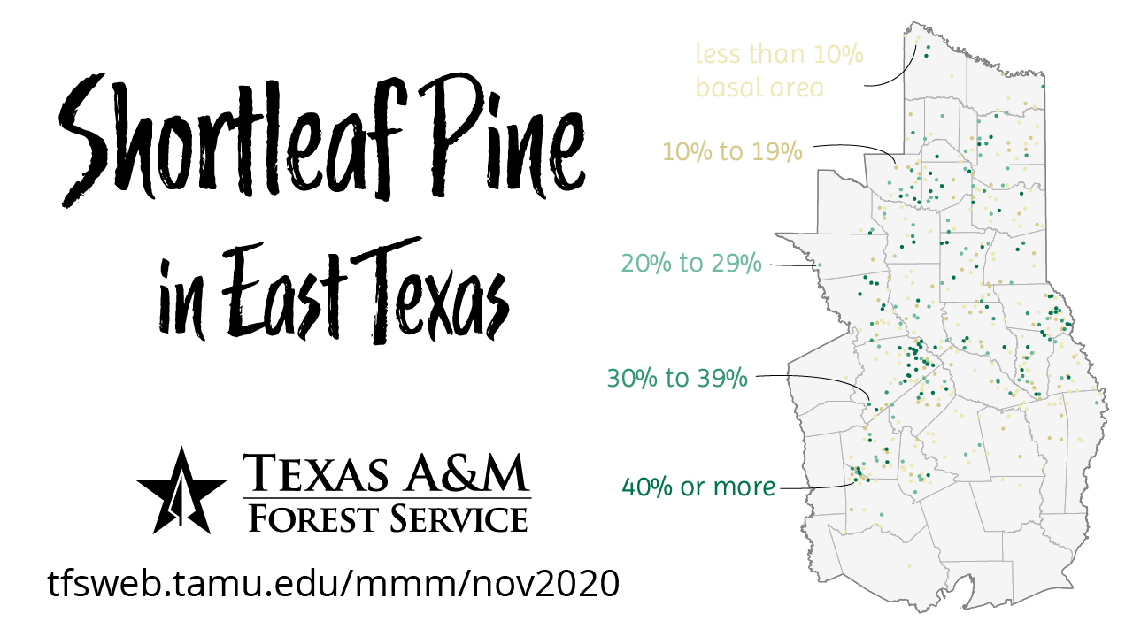
This month’s map depicts the prevalence of shortleaf pine in East Texas. I used Forest Inventory and Analysis data to compute the percent basal area of shortleaf pine, for trees 5” in diameter and above, on each plot at the last time it was measured (between 2015 and 2019). Management recommendations target sites with at least 20% existing basal area, so I used a color scheme that would make lower values fade into the background while accentuating higher values of at least 20%. This gives a general idea of where shortleaf pine occurs at what densities.
I also mapped the presence of shortleaf pine trees and seedlings on FIA plots with the most recent data. To give a sense of change over time, I mapped the presence and absence of the species for historical FIA inventories as well as the last few cycles of data under the current measurement system. For these maps, I included absence as well as presence because the plot grid changed and it could be misleading to directly compare presence alone from, say, 1975 to 2004. Another change in the plots occurred more recently that becomes visible starting in the 2014 map – data collection was intensified on the national forests, so the plots in those locations are more dense.