We created this map to get an initial idea of how much damage to forests Harvey caused. The U.S. Forest Service provided preliminary zones of wind-caused damage. Texas A&M Forest Service foresters on Harvey response provided feedback on the zones and the accuracy of their descriptions, leading to some minor adjustments. Roughly 45% of forestland received canopy disturbance in the moderate zone and 15% in the light zone. Combining the zones and their respective percentages with a forest-type map developed by TFS, the disturbed forestland area amounts to a total of about half a million acres — 265,000 in the moderate zone and 239,000 in the light zone. Live oak and mesquite are the predominant forest types in this area. Damage in the third zone, scattered light, was minor and dispersed, with less than 5% of forestland receiving canopy disturbance, so damaged acres were not calculated.
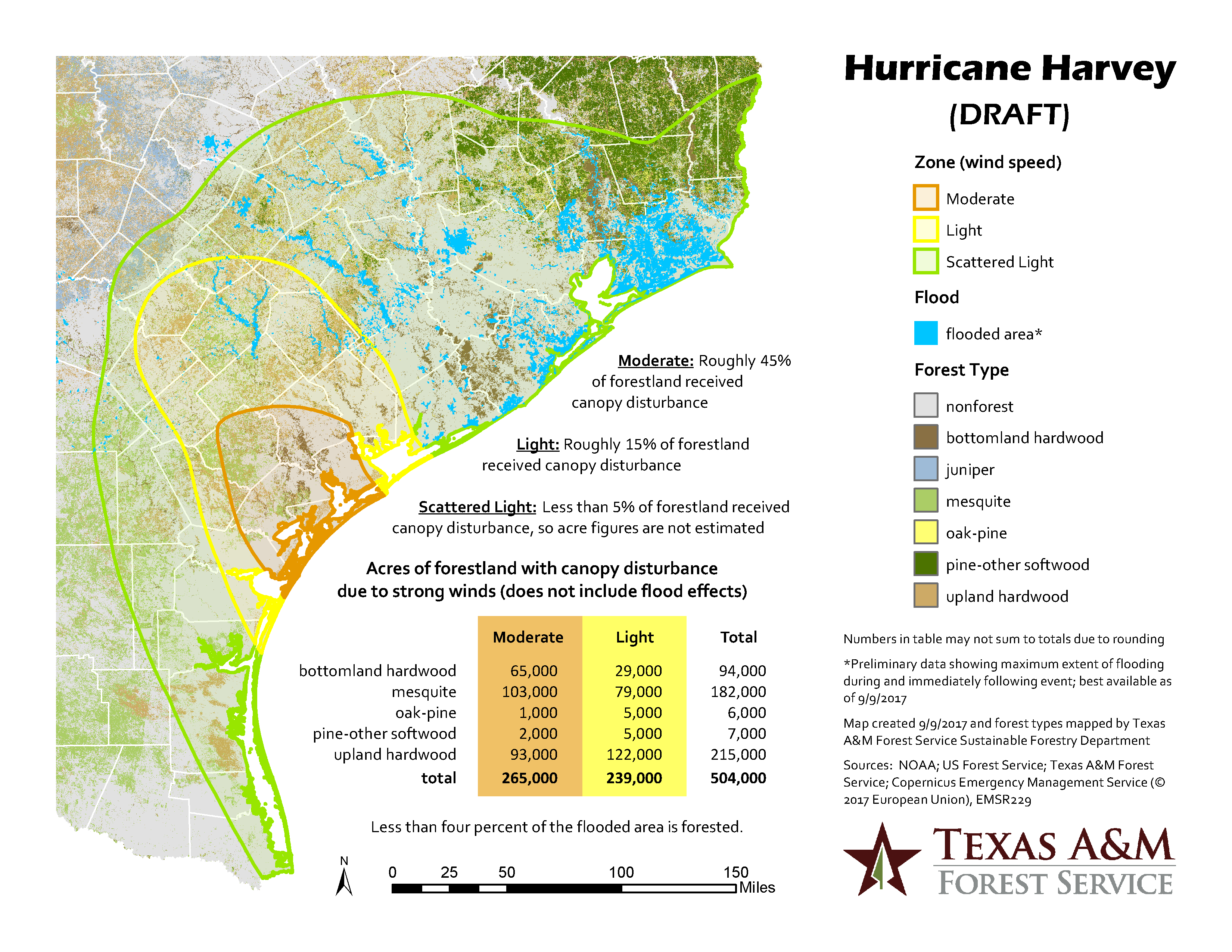
Flooded areas over much of the area affected by Harvey-associated rainfall were mapped by Copernicus Emergency Management Service. Less than four percent of the area that flooded during Harvey is forested.