I made this map at the request of the Texas Forestry Association for their museum in Lufkin. It’s designed to be printed 2′ square. I previously developed the forest type layer from FIA data and a suite of environmental predictor variables. We’ll get into that another month.
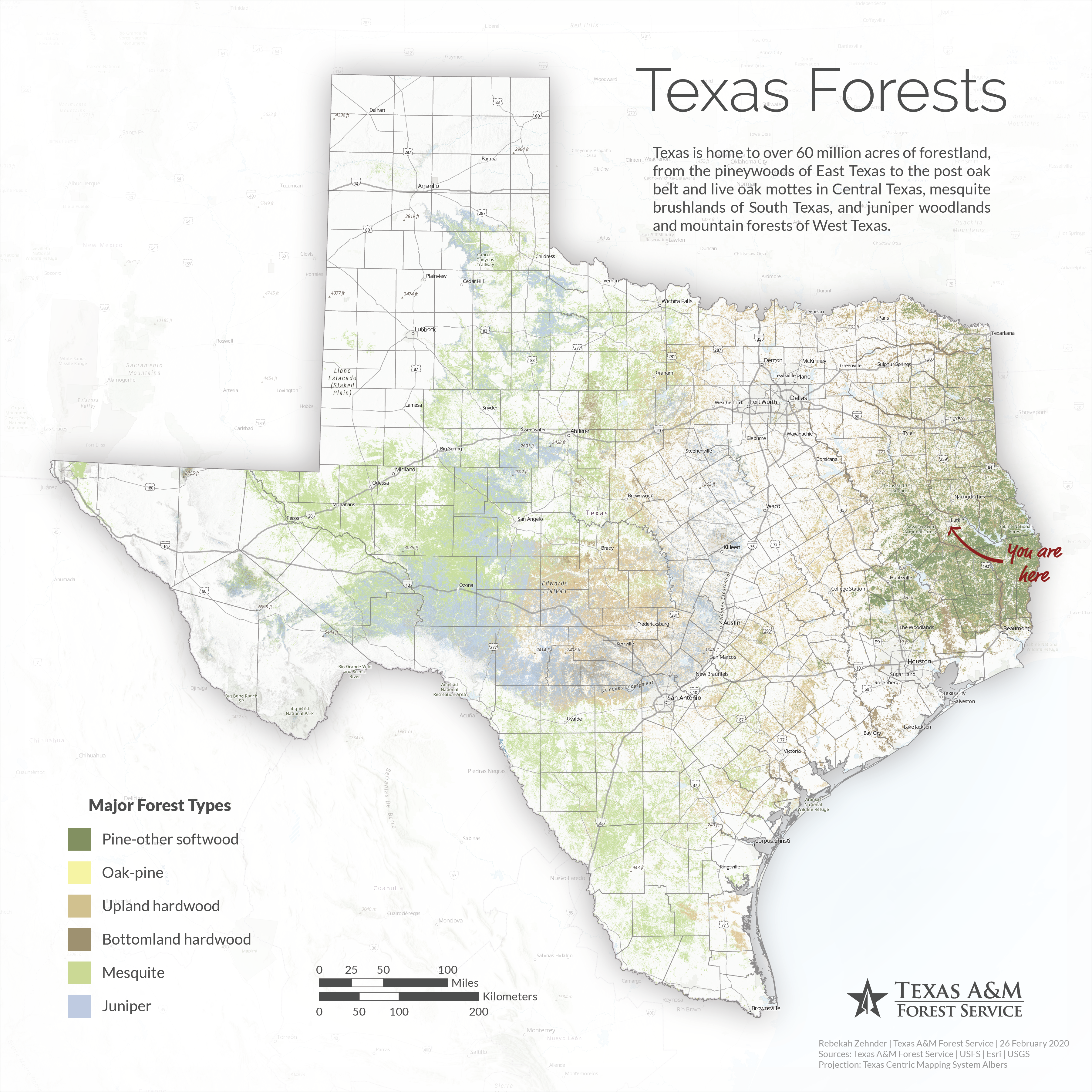
I used a combination of ArcGIS Pro, Adobe Illustrator, and Adobe Photoshop to make this map. The basemap — cities and towns, roads, place labels — is Esri’s topographic basemap, which you often see in maps on the web. Once in Adobe Illustrator, I separated the Texas labels from the non-Texas labels so I could keep the Texas things on top while letting the others fall into the background. I wanted the roads isolated, too, so I could show them with a little more emphasis than the rest of the basemap, so I made a copy of the basemap with just the roads using Esri’s Vector Tile Style Editor. I have a spatial layer called “Not Texas” that I use to diminish areas outside Texas without completely eliminating them. In this map, I used that as a transparent white gradient overlay formatted in Photoshop to soften the background. I also used Photoshop to create the shadow effect around Texas. In addition to the basemap, I’m showing terrain effects with a multi-directional hillshade created from USGS elevation data. This hillshade is mostly transparent and is shown on top of the forest type layer. Finally, text and graphic elements are a dark gray to provide contrast without the harshness of solid black, except for the “You are here” callout, which is red to pop out against the rest of the colors of the map.