Monthly Map Monday
All Resources on Monthly Map Monday
-
Already the second most populous state in the country, Texas is one of the fastest-growing states, with an estimated 1,000 people moving to the state each day. Rapidly growing communities must invest in quality infrastructure to better ensure a happy, healthy life for residents. Trees can help! Being around trees, even just having views of […]
-
A Wordle-Style Forest Map
News Story
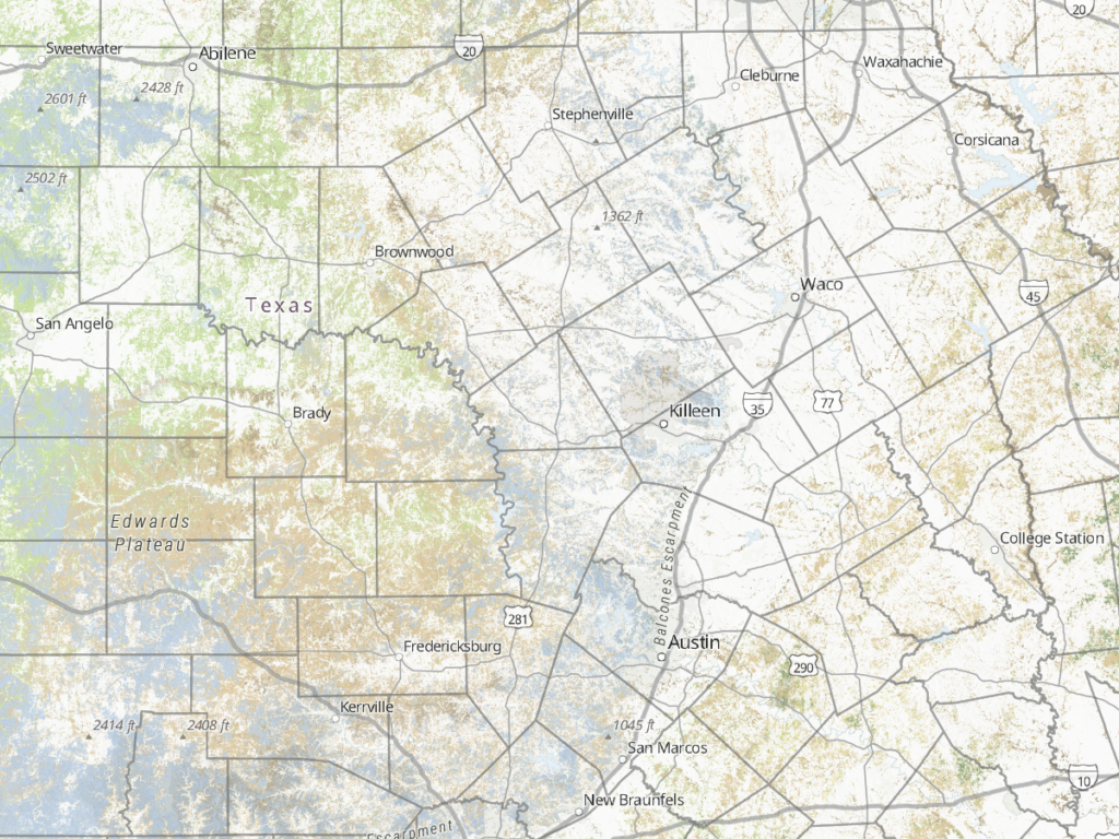
As social media feeds have been taken over by yellow and green squares, it seemed like a good idea to make a Wordle-style forest map. This effort was inspired by Alasdair Rae’s worldle maps. The base of this map is a 30-meter resolution map of forest in Texas, which you can read more about here. To turn […] -
Arbor Day: Tree Line USA
News Story
Tree Line USA is an Arbor Day Foundation program that recognizes best practices in public and private utility arboriculture, demonstrating how trees and utilities can co-exist for the benefit of communities and citizens. Participating utilities adhere to five core standards: quality tree care, annual worker training, tree planting and public education, tree-based energy conservation program, and […] -
Arbor Day: Tree City USA
News Story
Tree City USA is an Arbor Day Foundation program that provides communities with a four-step framework to maintain and grow their tree cover. It also gives them an avenue to celebrate their work, showing residents, visitors, and the entire country that they’re committed to the mission of environmental change. One of the standards communities must meet […] -
Arbor Day: Tree Campus Higher Education
News Story
Trees and green space make campuses more livable, healthy, and beautiful, benefiting students and the environment as a whole. The Arbor Day Foundation’s Tree Campus Higher Education program provides a simple framework for colleges and universities to grow their community forests, achieve national recognition, and create a campus their students and staff are proud of. In Texas, […] -
Funding Connector
News Story
The Funding Connector website is a clearinghouse for information about various natural resource programs that offer financial assistance to Texas landowners. This site helps landowners quickly determine if they are eligible for these programs. The Funding Connector is located on the Texas Forest Information Portal. To access it, go to texasforestinfo.tamu.edu/fundingconnector. Once there, you can search available […] -
Texas Big Tree Registry
News Story
Do you know or have visited the largest known specimens of each tree species growing in Texas? In some cases, these trees could be the largest in the country! Texas A&M Forest Service developed the Big Tree Registry website, which displays tree measurements and photos as well as public tree locations. It also features a map that […] -
Urban Tree Canopy
News Story
Urban Tree Canopy (UTC) is the layer of leaves, branches, and stems or trees that cover the ground when viewed from above. These trees, all public and private trees in the community, comprise the Urban Forest and provide valuable services and benefits. The UTC application displays predicted urban growth areas, UTC for selected communities and models […] -
Southern Timber Supply Analysis Data Update
News Story
Data in the Southern Timber Supply Analysis application has been updated to reflect the latest data available from Forest Inventory and Analysis. The new data was downloaded from the FIA DataMart on 6 May 2021. Alabama, Georgia, Oklahoma, South Carolina, and Virginia added another year of data since the last update. Data for states within 100 miles of the […] -
Cross Timbers Forest
News Story
The east and west cross timbers comprise important ecoregions in north Texas. This map shows forestland in those ecoregions. The forestland was mapped from Forest Inventory and Analysis data and a suite of environmental variables. You can read more about it here. The ecoregions are EPA Level IV ecoregions, and you can learn more about them here. […] -
Ice Damage in Central Texas
News Story
In February, Texas experienced historic winter storms. Our Central Texas staff performed roadside assessments of tree damage following the ice events that occurred in their area on February 11th and February 17th. ArcGIS Collector was used for the data collection, with an ArcGIS Online viewer for managers to see the data (including photos) being collected […] -
Longleaf Pine in East Texas
News Story
[Jump straight to the maps] This month’s map is a follow up to the shortleaf pine maps from November and depicts the prevalence of longleaf pine in East Texas. I used Forest Inventory and Analysis data to compute the percent basal area of longleaf pine, for trees 5” in diameter and above, on each plot at the […] -
Christmas Tree Farms
News Story
You may not immediately think “Texas” when you hear something about Christmas tree farms, but the Christmas tree industry is alive and well (and growing!) in our state. The Texas Christmas Tree Growers Association maintains information on member farms and makes it available on their website. This month’s map was made from that information. I grabbed the tree […] -
Shortleaf Pine in East Texas
News Story
[Jump straight to the maps] This month’s map depicts the prevalence of shortleaf pine in East Texas. I used Forest Inventory and Analysis data to compute the percent basal area of shortleaf pine, for trees 5” in diameter and above, on each plot at the last time it was measured (between 2015 and 2019). Management recommendations target […] -
Hurricanes Laura and Delta
News Story
Hurricane Delta, the second hurricane to threaten Texas in as many months, made landfall on October 9th, 2020, near Creole, Louisiana, as a Category-2 hurricane. No hurricane-force winds occurred in Texas. Maximum sustained winds of 39 to 57 miles per hour affected approximately the same area in East Texas that experienced hurricane- or tropical storm-force […] -
Timber Supply Analysis of the U.S. South
News Story
The latest update to the Timber Supply Analysis application brings you standard reports for the entire southern region – as a whole. So just how much timber does the South have? Measurement Data Area 202 million acres of timberland Volume 389 billion cubic feet of timber Weight 12 billion green short tons of timber Growth […] -
Hurricane Laura
News Story
Hurricane Laura made landfall in the early hours of August 27, 2020, at Cameron, Louisiana, as a Category-4 hurricane, soon slowing to a Category-2. Hurricane-force winds (Category-1) swept through a small portion of the eastern edge of East Texas, with tropical-storm-force winds extending somewhat farther into East Texas. As part of an ongoing process to […] -
My City’s Trees: San Diego edition
News Story
San Diego Urban Forest Inventory & Analysis data has been added to the My City’s Trees web application. San Diego is the first city outside of Texas to be included in the application. What does this mean? It means you can use My City’s Trees to explore the structure and values of San Diego’s urban forest. My City’s […] -
Timber Supply Analysis Update
News Story
We updated the Timber Supply Analysis application to include forest inventory data for states within 100 miles of the Southern Region, allowing users to accurately conduct supply analyses that extend outside of the Southern Region. The area of interest (supply point) must still originate inside the Southern Region for the analysis to be conducted. Additionally, […] -
Memorial Day Burn Bans
News Story
Burn bans are set by county judges and/or county commissioners’ courts as an important preventative measure to protect Texans from wildfires. When conditions are hot, dry, and windy, fires can spread very easily. Prohibiting outdoor burning helps mitigate that risk. Texas A&M Forest produces a statewide burn map daily based on information received from the […] -
Polk County Tornado Rapid Damage Assessment
News Story
A tornado touched down in Polk County on April 22, 2020, in the area of Onalaska and Seven Oaks. We conducted a rapid damage assessment to estimate the amount of timber damaged by the storm. One of our foresters mapped the approximate boundary of the tornado’s path from a DPS helicopter. He also photographed much of the […] -
Texas Forests
News Story
I made this map at the request of the Texas Forestry Association for their museum in Lufkin. It’s designed to be printed 2′ square. I previously developed the forest type layer from FIA data and a suite of environmental predictor variables. We’ll get into that another month. I used a combination of ArcGIS Pro, Adobe Illustrator, and Adobe Photoshop to make […] -
Office Locations
News Story
As the state forestry agency of Texas, we have offices scattered across the state to help us serve all Texans. Our headquarters are in College Station, where we have 120 employees, but we also have offices in 59 other Texas cities or towns. You can see a little bit of our history through the map, […] -
Forest Management Plans in Time and Space
News Story
Foresters in East Texas help landowners develop forest management plans to sustainably manage their forestland. I created this animation to visualize the impact of their work over the last 10 years. We have an internal tracking system to keep information on all the management plans our foresters create. This includes spatial data, which I pulled from the […] -
Last month we took a look at where the forest inventory data in the Southern Timber Supply Analysis application comes from and the process to get it in a form the app can use. But what happens when you actually run an analysis in the app – what is happening behind the scenes when you hit the “Summary […]
-
Southern Timber Supply Analysis is a web application that uses Forest Inventory & Analysis data to evaluate the supply potential of a user-specified area within the southern United States. This month we’ll take a look at the data that underlies the app and how it is prepared. FIA data is available to the public via the FIA […]
-
Scenic Views and You
News Story
Though it may not feel like it, fall is here. And fall means beautiful displays of leaves changing colors. But where are the most beautiful places to see fall foliage? We have some ideas, but we’re asking you to do some of the mapping for this. The new Texas Scenic Views web application is designed […] -
Bastrop is no stranger to the devastation that wildfire can bring to a community. Eight years ago, Bastrop witnessed the most devastating wildfires in the history of Texas. The Bastrop County Complex wildfire covered 32,400 acres, of which 75 percent saw extreme fire intensity levels. 1,660 homes and 36 commercial buildings were destroyed and the […]
-
Happy Geocaching
News Story
Geocaching is an outdoor treasure hunt using GPS-enabled devices. Geocaching is fun for all ages and comes in all sizes, shapes and experience levels. It makes every day interesting and keeps you curious when you set off in search of a geocache. When you actually fine one, it is very satisfying! We have a series […] -
Texas State Forests and Arboretums
News Story
Texas A&M Forest Service manages five state forests and two arboretums for the benefit of Texans. The state forests are working forests — they produce timber resources — that are managed to demonstrate sound forest management practices. In the arboretums, a variety of trees are grown for research, educational, memorial and ornamental purposes. Visit our […] -
Springtime = Baby Birds
News Story
The sights and sounds of spring surround us — from blooming wildflowers and buzzing bees to budding trees and chirping birds. Bird activity is one of the most noticeable signs of spring, but not all species are equally noticeable. Among the less noticeable, red-cockaded woodpeckers are an endangered species that lives in open, mature pine […] -
Drought Outlook
News Story
Over the course of the last month, much of the state has been affected by abnormal dryness or drought. The outlook is positive, though, with conditions in all drought areas as of March 19 expected to improve by the end of June. Most of the area is expected to come out of drought. One percent […] -
Alto Tornado Preliminary Damage Assessment
News Story
To get a preliminary idea of the possible extent of damage to forest resources in the area, we intersected the path of the tornado with our forest-type map. Not all of the area within the path was damaged, so these estimates represent an upper limit on the affected area. A significant portion of the tornado’s […] -
Chinese Tallow: Urban Invasion
News Story
The last couple months we’ve looked at Chinese tallow from a rural perspective. It is not only a rural issue, though — Chinese tallow is also invading urban areas. For example, Houston has about 5.7 million Chinese tallowtrees at least one inch in diameter, which account for 17 percent of its overall tree population. Of these, 4.6 […] -
Chinese Tallow: Where Will It Go Next?
News Story
Last month we looked at the historical and current distribution of Chinese tallow – an invasive species problematic for forests – in East Texas. To curb the spread and effectively manage, it is helpful to know what kinds of sites are most susceptible to Chinese tallow invasion. In addition to tree data, Forest Inventory and Analysis collects many […] -
Chinese Tallow: A Ruthless Invader
News Story
Chinese tallow is an invasive species spreading through Texas forests. It threatens our ecosystems by outcompeting native vegetation, degrading soil conditions, and negatively impacting wildlife. Its leaves and fruit are literally toxic! An important part of managing an invasive species is knowing where it is occurring and how its distribution is changing over time. Through Forest […] -
Gobble Gobble
News Story
With Thanksgiving just a few days away, turkeys are on many people’s minds. Texas A&M Forest Service recently partnered with the National Wild Turkey Federation to improve turkey habitat — foraging, roosting, and nesting sites — on the I.D. Fairchild State Forest in East Texas. The project included mulching, herbicide applications, and prescribed fire on two different […] -
Last month we looked at the status of longleaf pine in East Texas; its coverage has diminished significantly over time. Is this important, and if so, what can be done about it? Longleaf ecosystems have some of the most diverse and unique understories, second only to tropical rainforest in plant diversity. These ecosystems and their […]
-
Longleaf Pine Part 1: Status
News Story
Longleaf pine forests historically covered much the southern United States from the Carolinas to Florida west to Texas, but have dwindled to only a few million acres across the range. Longleaf pine is an iconic tree species desired due to its wood properties and strength. Many homes and buildings built across the south in the […] -
Economic Impact
News Story
The forest industry is an important part of the East Texas economy. This map shows the total economic contribution by county in 2015. The forest sector in the 43-county region had a total economic impact of $11.2 billion in industry output, supporting over 47,500 jobs with a payroll of $2.9 billion. Explore the Texas Forest Sector […] -
I’d Rather Be a Forest than a Street
News Story
What about a forest on a street? Street trees are one important part of what makes up the urban forest — all the trees in a community. Trees in backyards, parks, and other areas throughout the city are also part of the urban forest. Trees in the right places contribute to our health, wallets, and overall well-being. […] -
Fire on the Mountain
News Story
The McDannald fire burned 19,043 acres from April 30 to May 14 in Jeff Davis County. The fire was started by a lightning strike. The starkness of the burned area stands out in a satellite image showing shortwave infrared and near infrared. For more on how we trick our eyes into seeing more in satellite […] -
Edwin Land unveiled the Polaroid Land Camera, Miracle on 34th Street made its Hollywood debut, and Howard Hughes piloted the Spruce Goose — a wooden flying boat — on its one and only voyage. And TFS made a map of the forest regions of Texas. This map, likely produced by the Information and Education Chief […]
-
Hardwood Mortality
News Story
These maps show Forest Inventory and Analysis (FIA) plots from the 2006, 2011, and 2016 inventories. In East Texas, 20 percent of an inventory’s plots are measured each year, so for example, the 2016 inventory contains data collected from 2012 to 2016. The first annual inventory was completed in 2003. Since mortality is a change […] -
An Urban Oasis
News Story
Housing developments are steadily closing in on the borders of W. Goodrich Jones State Forest. The forest is located in the busy commercial corridor along Interstate 45 north of Houston and offers a slice of solitude to the many residents of the surrounding area. The solid forested area is striking from above, with residential streets […] -
Texas in Winter
News Story
Ever wonder what Texas looks like from above — way above? These images were taken from a satellite passing over Earth. Since Texas is so big, it’s actually several images that have been mashed together, or in technical terms, mosaicked to form a composite image. The first image is what Texas would typically look like […] -
Forests of Texas
News Story
There are 63.2 million acres of forestland across the state of Texas. That’s slightly more area than the entire state of Wyoming. We know how much forestland is in Texas because of Forest Inventory and Analysis (FIA), a partnership between the Texas A&M Forest Service and the U.S. Forest Service to collect data throughout the […] -
Sixty Years of Austin Growth
News Story
Map-making doesn’t always have to be complicated. This map that shows the growth of Austin over the past 60 years is simply a screen clipping from a website with some text added to it. The orange-ish color is what comprised Austin as of December 31, 1949. The yellow parts were annexed in the 1950s and […] -
Cowtown Famous Trees
News Story
This map highlights a tour of famous trees in the Fort Worth, Texas area. Famous trees are trees that have witnessed exciting events in Texas’ frontier history. It’s been said that every tree tells a story. And if Texas’ trees could speak, what stories they would tell — stories of love, honor, mystery, justice and […] -
Hurricane Harvey Preliminary Forest Impact
News Story
We created this map to get an initial idea of how much damage to forests Harvey caused. The U.S. Forest Service provided preliminary zones of wind-caused damage. Texas A&M Forest Service foresters on Harvey response provided feedback on the zones and the accuracy of their descriptions, leading to some minor adjustments. Roughly 45% of forestland […] -
A Decade of August Drought Conditions
News Story
If you stop a Texan in the street and mention drought, you’re likely to hear some stories about 2011. While Texas is no stranger to drought — stop a seasoned Texan in the street and ask about the 1950s — it certainly became a hot topic in the years surrounding 2011. The 2011 drought was remarkable because […]
-
Already the second most populous state in the country, Texas is one of the fastest-growing states, with an estimated 1,000 people moving to the state each day. Rapidly growing communities must invest in quality infrastructure to better ensure a happy, healthy life for residents. Trees can help! Being around trees, even just having views of […]
-
A Wordle-Style Forest Map
News Story
As social media feeds have been taken over by yellow and green squares, it seemed like a good idea to make a Wordle-style forest map. This effort was inspired by Alasdair Rae’s worldle maps. The base of this map is a 30-meter resolution map of forest in Texas, which you can read more about here. To turn […] -
Arbor Day: Tree Line USA
News Story
Tree Line USA is an Arbor Day Foundation program that recognizes best practices in public and private utility arboriculture, demonstrating how trees and utilities can co-exist for the benefit of communities and citizens. Participating utilities adhere to five core standards: quality tree care, annual worker training, tree planting and public education, tree-based energy conservation program, and […] -
Arbor Day: Tree City USA
News Story
Tree City USA is an Arbor Day Foundation program that provides communities with a four-step framework to maintain and grow their tree cover. It also gives them an avenue to celebrate their work, showing residents, visitors, and the entire country that they’re committed to the mission of environmental change. One of the standards communities must meet […] -
Arbor Day: Tree Campus Higher Education
News Story
Trees and green space make campuses more livable, healthy, and beautiful, benefiting students and the environment as a whole. The Arbor Day Foundation’s Tree Campus Higher Education program provides a simple framework for colleges and universities to grow their community forests, achieve national recognition, and create a campus their students and staff are proud of. In Texas, […] -
Funding Connector
News Story
The Funding Connector website is a clearinghouse for information about various natural resource programs that offer financial assistance to Texas landowners. This site helps landowners quickly determine if they are eligible for these programs. The Funding Connector is located on the Texas Forest Information Portal. To access it, go to texasforestinfo.tamu.edu/fundingconnector. Once there, you can search available […] -
Texas Big Tree Registry
News Story
Do you know or have visited the largest known specimens of each tree species growing in Texas? In some cases, these trees could be the largest in the country! Texas A&M Forest Service developed the Big Tree Registry website, which displays tree measurements and photos as well as public tree locations. It also features a map that […] -
Urban Tree Canopy
News Story
Urban Tree Canopy (UTC) is the layer of leaves, branches, and stems or trees that cover the ground when viewed from above. These trees, all public and private trees in the community, comprise the Urban Forest and provide valuable services and benefits. The UTC application displays predicted urban growth areas, UTC for selected communities and models […] -
Southern Timber Supply Analysis Data Update
News Story
Data in the Southern Timber Supply Analysis application has been updated to reflect the latest data available from Forest Inventory and Analysis. The new data was downloaded from the FIA DataMart on 6 May 2021. Alabama, Georgia, Oklahoma, South Carolina, and Virginia added another year of data since the last update. Data for states within 100 miles of the […] -
Cross Timbers Forest
News Story
The east and west cross timbers comprise important ecoregions in north Texas. This map shows forestland in those ecoregions. The forestland was mapped from Forest Inventory and Analysis data and a suite of environmental variables. You can read more about it here. The ecoregions are EPA Level IV ecoregions, and you can learn more about them here. […] -
Ice Damage in Central Texas
News Story
In February, Texas experienced historic winter storms. Our Central Texas staff performed roadside assessments of tree damage following the ice events that occurred in their area on February 11th and February 17th. ArcGIS Collector was used for the data collection, with an ArcGIS Online viewer for managers to see the data (including photos) being collected […] -
Longleaf Pine in East Texas
News Story
[Jump straight to the maps] This month’s map is a follow up to the shortleaf pine maps from November and depicts the prevalence of longleaf pine in East Texas. I used Forest Inventory and Analysis data to compute the percent basal area of longleaf pine, for trees 5” in diameter and above, on each plot at the […] -
Christmas Tree Farms
News Story
You may not immediately think “Texas” when you hear something about Christmas tree farms, but the Christmas tree industry is alive and well (and growing!) in our state. The Texas Christmas Tree Growers Association maintains information on member farms and makes it available on their website. This month’s map was made from that information. I grabbed the tree […] -
Shortleaf Pine in East Texas
News Story
[Jump straight to the maps] This month’s map depicts the prevalence of shortleaf pine in East Texas. I used Forest Inventory and Analysis data to compute the percent basal area of shortleaf pine, for trees 5” in diameter and above, on each plot at the last time it was measured (between 2015 and 2019). Management recommendations target […] -
Hurricanes Laura and Delta
News Story
Hurricane Delta, the second hurricane to threaten Texas in as many months, made landfall on October 9th, 2020, near Creole, Louisiana, as a Category-2 hurricane. No hurricane-force winds occurred in Texas. Maximum sustained winds of 39 to 57 miles per hour affected approximately the same area in East Texas that experienced hurricane- or tropical storm-force […] -
Timber Supply Analysis of the U.S. South
News Story
The latest update to the Timber Supply Analysis application brings you standard reports for the entire southern region – as a whole. So just how much timber does the South have? Measurement Data Area 202 million acres of timberland Volume 389 billion cubic feet of timber Weight 12 billion green short tons of timber Growth […] -
Hurricane Laura
News Story
Hurricane Laura made landfall in the early hours of August 27, 2020, at Cameron, Louisiana, as a Category-4 hurricane, soon slowing to a Category-2. Hurricane-force winds (Category-1) swept through a small portion of the eastern edge of East Texas, with tropical-storm-force winds extending somewhat farther into East Texas. As part of an ongoing process to […] -
My City’s Trees: San Diego edition
News Story
San Diego Urban Forest Inventory & Analysis data has been added to the My City’s Trees web application. San Diego is the first city outside of Texas to be included in the application. What does this mean? It means you can use My City’s Trees to explore the structure and values of San Diego’s urban forest. My City’s […] -
Timber Supply Analysis Update
News Story
We updated the Timber Supply Analysis application to include forest inventory data for states within 100 miles of the Southern Region, allowing users to accurately conduct supply analyses that extend outside of the Southern Region. The area of interest (supply point) must still originate inside the Southern Region for the analysis to be conducted. Additionally, […] -
Memorial Day Burn Bans
News Story
Burn bans are set by county judges and/or county commissioners’ courts as an important preventative measure to protect Texans from wildfires. When conditions are hot, dry, and windy, fires can spread very easily. Prohibiting outdoor burning helps mitigate that risk. Texas A&M Forest produces a statewide burn map daily based on information received from the […] -
Polk County Tornado Rapid Damage Assessment
News Story
A tornado touched down in Polk County on April 22, 2020, in the area of Onalaska and Seven Oaks. We conducted a rapid damage assessment to estimate the amount of timber damaged by the storm. One of our foresters mapped the approximate boundary of the tornado’s path from a DPS helicopter. He also photographed much of the […] -
Texas Forests
News Story
I made this map at the request of the Texas Forestry Association for their museum in Lufkin. It’s designed to be printed 2′ square. I previously developed the forest type layer from FIA data and a suite of environmental predictor variables. We’ll get into that another month. I used a combination of ArcGIS Pro, Adobe Illustrator, and Adobe Photoshop to make […] -
Office Locations
News Story
As the state forestry agency of Texas, we have offices scattered across the state to help us serve all Texans. Our headquarters are in College Station, where we have 120 employees, but we also have offices in 59 other Texas cities or towns. You can see a little bit of our history through the map, […] -
Forest Management Plans in Time and Space
News Story
Foresters in East Texas help landowners develop forest management plans to sustainably manage their forestland. I created this animation to visualize the impact of their work over the last 10 years. We have an internal tracking system to keep information on all the management plans our foresters create. This includes spatial data, which I pulled from the […] -
Last month we took a look at where the forest inventory data in the Southern Timber Supply Analysis application comes from and the process to get it in a form the app can use. But what happens when you actually run an analysis in the app – what is happening behind the scenes when you hit the “Summary […]
-
Southern Timber Supply Analysis is a web application that uses Forest Inventory & Analysis data to evaluate the supply potential of a user-specified area within the southern United States. This month we’ll take a look at the data that underlies the app and how it is prepared. FIA data is available to the public via the FIA […]
-
Scenic Views and You
News Story
Though it may not feel like it, fall is here. And fall means beautiful displays of leaves changing colors. But where are the most beautiful places to see fall foliage? We have some ideas, but we’re asking you to do some of the mapping for this. The new Texas Scenic Views web application is designed […] -
Bastrop is no stranger to the devastation that wildfire can bring to a community. Eight years ago, Bastrop witnessed the most devastating wildfires in the history of Texas. The Bastrop County Complex wildfire covered 32,400 acres, of which 75 percent saw extreme fire intensity levels. 1,660 homes and 36 commercial buildings were destroyed and the […]
-
Happy Geocaching
News Story
Geocaching is an outdoor treasure hunt using GPS-enabled devices. Geocaching is fun for all ages and comes in all sizes, shapes and experience levels. It makes every day interesting and keeps you curious when you set off in search of a geocache. When you actually fine one, it is very satisfying! We have a series […] -
Texas State Forests and Arboretums
News Story
Texas A&M Forest Service manages five state forests and two arboretums for the benefit of Texans. The state forests are working forests — they produce timber resources — that are managed to demonstrate sound forest management practices. In the arboretums, a variety of trees are grown for research, educational, memorial and ornamental purposes. Visit our […] -
Springtime = Baby Birds
News Story
The sights and sounds of spring surround us — from blooming wildflowers and buzzing bees to budding trees and chirping birds. Bird activity is one of the most noticeable signs of spring, but not all species are equally noticeable. Among the less noticeable, red-cockaded woodpeckers are an endangered species that lives in open, mature pine […] -
Drought Outlook
News Story
Over the course of the last month, much of the state has been affected by abnormal dryness or drought. The outlook is positive, though, with conditions in all drought areas as of March 19 expected to improve by the end of June. Most of the area is expected to come out of drought. One percent […] -
Alto Tornado Preliminary Damage Assessment
News Story
To get a preliminary idea of the possible extent of damage to forest resources in the area, we intersected the path of the tornado with our forest-type map. Not all of the area within the path was damaged, so these estimates represent an upper limit on the affected area. A significant portion of the tornado’s […] -
Chinese Tallow: Urban Invasion
News Story
The last couple months we’ve looked at Chinese tallow from a rural perspective. It is not only a rural issue, though — Chinese tallow is also invading urban areas. For example, Houston has about 5.7 million Chinese tallowtrees at least one inch in diameter, which account for 17 percent of its overall tree population. Of these, 4.6 […] -
Chinese Tallow: Where Will It Go Next?
News Story
Last month we looked at the historical and current distribution of Chinese tallow – an invasive species problematic for forests – in East Texas. To curb the spread and effectively manage, it is helpful to know what kinds of sites are most susceptible to Chinese tallow invasion. In addition to tree data, Forest Inventory and Analysis collects many […] -
Chinese Tallow: A Ruthless Invader
News Story
Chinese tallow is an invasive species spreading through Texas forests. It threatens our ecosystems by outcompeting native vegetation, degrading soil conditions, and negatively impacting wildlife. Its leaves and fruit are literally toxic! An important part of managing an invasive species is knowing where it is occurring and how its distribution is changing over time. Through Forest […] -
Gobble Gobble
News Story
With Thanksgiving just a few days away, turkeys are on many people’s minds. Texas A&M Forest Service recently partnered with the National Wild Turkey Federation to improve turkey habitat — foraging, roosting, and nesting sites — on the I.D. Fairchild State Forest in East Texas. The project included mulching, herbicide applications, and prescribed fire on two different […] -
Last month we looked at the status of longleaf pine in East Texas; its coverage has diminished significantly over time. Is this important, and if so, what can be done about it? Longleaf ecosystems have some of the most diverse and unique understories, second only to tropical rainforest in plant diversity. These ecosystems and their […]
-
Longleaf Pine Part 1: Status
News Story
Longleaf pine forests historically covered much the southern United States from the Carolinas to Florida west to Texas, but have dwindled to only a few million acres across the range. Longleaf pine is an iconic tree species desired due to its wood properties and strength. Many homes and buildings built across the south in the […] -
Economic Impact
News Story
The forest industry is an important part of the East Texas economy. This map shows the total economic contribution by county in 2015. The forest sector in the 43-county region had a total economic impact of $11.2 billion in industry output, supporting over 47,500 jobs with a payroll of $2.9 billion. Explore the Texas Forest Sector […] -
I’d Rather Be a Forest than a Street
News Story
What about a forest on a street? Street trees are one important part of what makes up the urban forest — all the trees in a community. Trees in backyards, parks, and other areas throughout the city are also part of the urban forest. Trees in the right places contribute to our health, wallets, and overall well-being. […] -
Fire on the Mountain
News Story
The McDannald fire burned 19,043 acres from April 30 to May 14 in Jeff Davis County. The fire was started by a lightning strike. The starkness of the burned area stands out in a satellite image showing shortwave infrared and near infrared. For more on how we trick our eyes into seeing more in satellite […] -
Edwin Land unveiled the Polaroid Land Camera, Miracle on 34th Street made its Hollywood debut, and Howard Hughes piloted the Spruce Goose — a wooden flying boat — on its one and only voyage. And TFS made a map of the forest regions of Texas. This map, likely produced by the Information and Education Chief […]
-
Hardwood Mortality
News Story
These maps show Forest Inventory and Analysis (FIA) plots from the 2006, 2011, and 2016 inventories. In East Texas, 20 percent of an inventory’s plots are measured each year, so for example, the 2016 inventory contains data collected from 2012 to 2016. The first annual inventory was completed in 2003. Since mortality is a change […] -
An Urban Oasis
News Story
Housing developments are steadily closing in on the borders of W. Goodrich Jones State Forest. The forest is located in the busy commercial corridor along Interstate 45 north of Houston and offers a slice of solitude to the many residents of the surrounding area. The solid forested area is striking from above, with residential streets […] -
Texas in Winter
News Story
Ever wonder what Texas looks like from above — way above? These images were taken from a satellite passing over Earth. Since Texas is so big, it’s actually several images that have been mashed together, or in technical terms, mosaicked to form a composite image. The first image is what Texas would typically look like […] -
Forests of Texas
News Story
There are 63.2 million acres of forestland across the state of Texas. That’s slightly more area than the entire state of Wyoming. We know how much forestland is in Texas because of Forest Inventory and Analysis (FIA), a partnership between the Texas A&M Forest Service and the U.S. Forest Service to collect data throughout the […] -
Sixty Years of Austin Growth
News Story
Map-making doesn’t always have to be complicated. This map that shows the growth of Austin over the past 60 years is simply a screen clipping from a website with some text added to it. The orange-ish color is what comprised Austin as of December 31, 1949. The yellow parts were annexed in the 1950s and […] -
Cowtown Famous Trees
News Story
This map highlights a tour of famous trees in the Fort Worth, Texas area. Famous trees are trees that have witnessed exciting events in Texas’ frontier history. It’s been said that every tree tells a story. And if Texas’ trees could speak, what stories they would tell — stories of love, honor, mystery, justice and […] -
Hurricane Harvey Preliminary Forest Impact
News Story
We created this map to get an initial idea of how much damage to forests Harvey caused. The U.S. Forest Service provided preliminary zones of wind-caused damage. Texas A&M Forest Service foresters on Harvey response provided feedback on the zones and the accuracy of their descriptions, leading to some minor adjustments. Roughly 45% of forestland […] -
A Decade of August Drought Conditions
News Story
If you stop a Texan in the street and mention drought, you’re likely to hear some stories about 2011. While Texas is no stranger to drought — stop a seasoned Texan in the street and ask about the 1950s — it certainly became a hot topic in the years surrounding 2011. The 2011 drought was remarkable because […]