Hurricane Laura
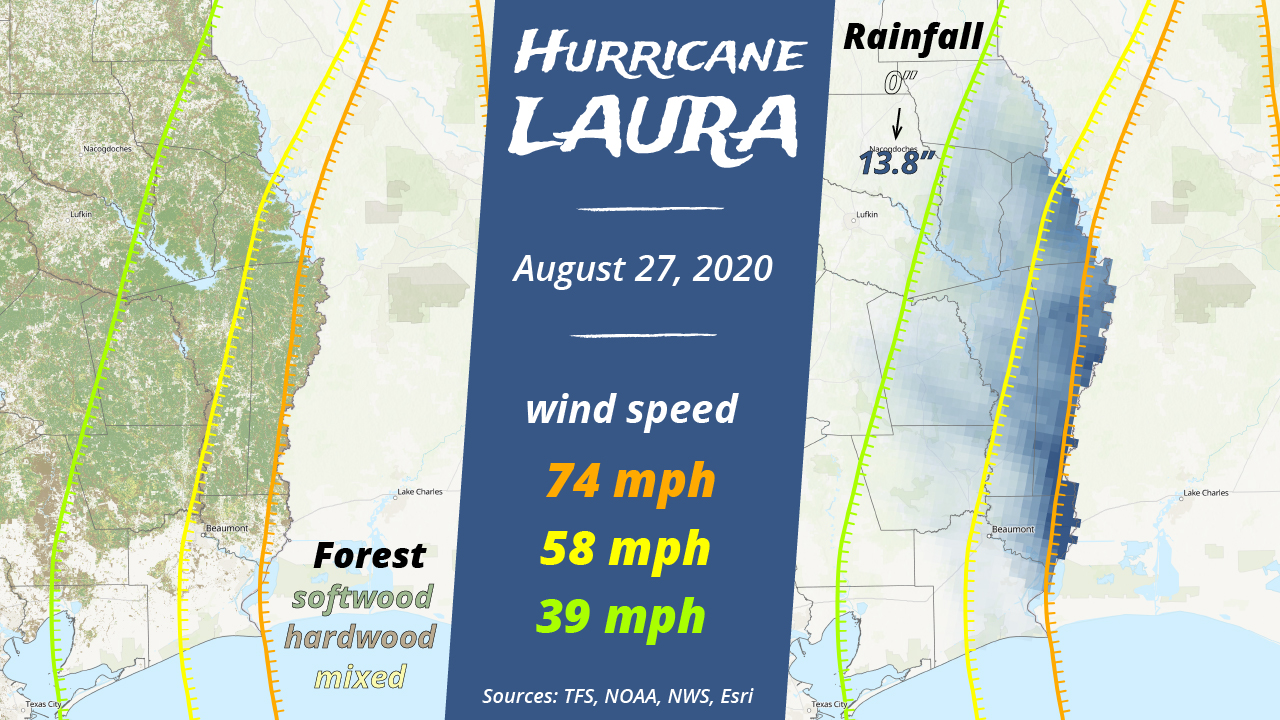
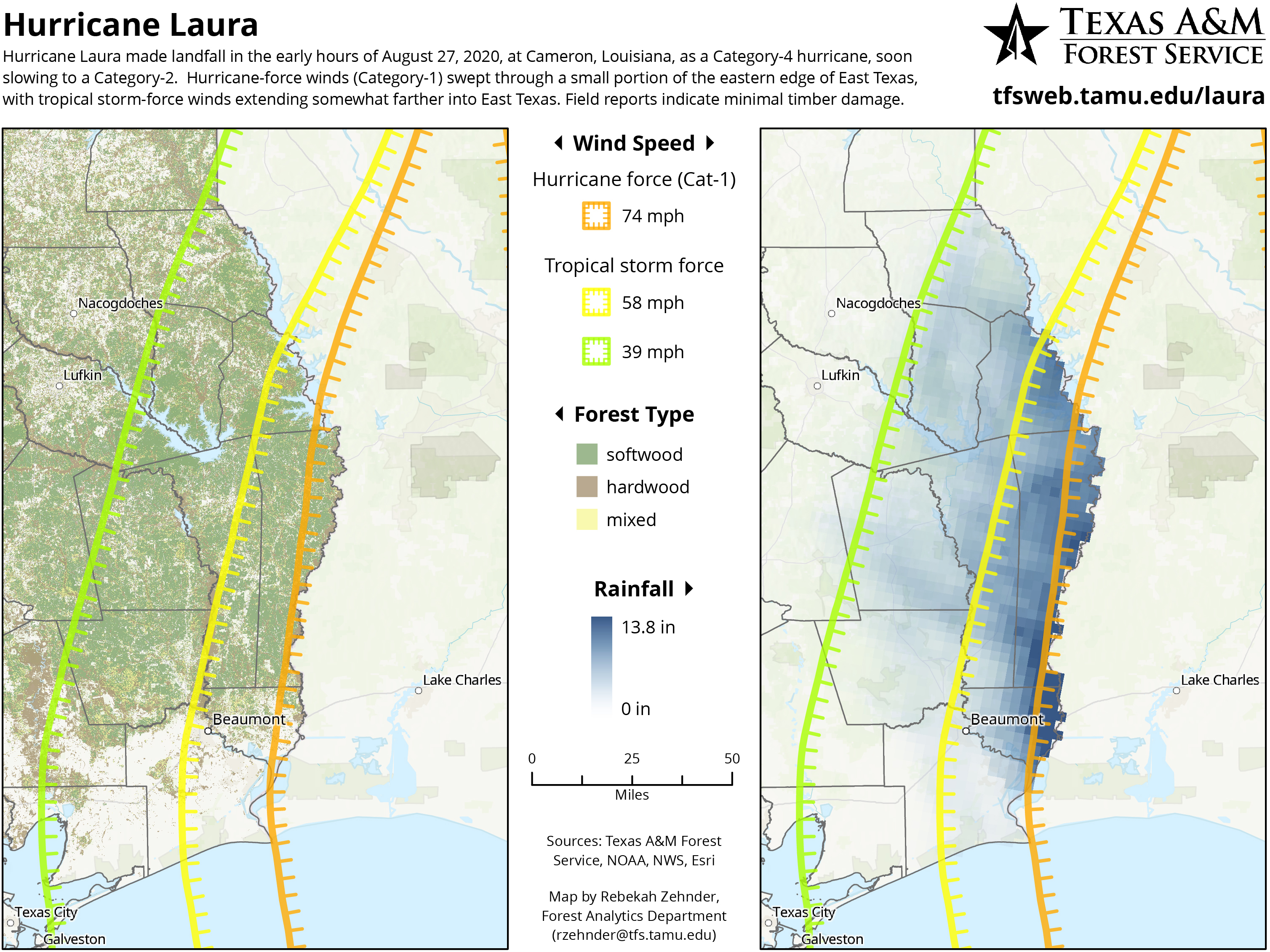
Hurricane Laura made landfall in the early hours of August 27, 2020, at Cameron, Louisiana, as a Category-4 hurricane, soon slowing to a Category-2. Hurricane-force winds (Category-1) swept through a small portion of the eastern edge of East Texas, with tropical storm-force winds extending somewhat farther into East Texas.
As part of an on-going process to stay apprised of the situation and assess potential impacts to East Texas timber, we used the wind speed data published by NOAA to see where strong winds had been. What you see here is the final version of the wind speed data, but we monitored www.nhc.noaa.gov for updates throughout the duration of the storm.
Rainfall data was downloaded from the National Weather Service’s Advanced Hydrologic Prediction Service and is the daily rainfall accumulation for August 27, 2020.
We wanted to see the hurricane data in the context of forest, so we are also showing our forest type map derived from Forest Inventory & Analysis and environmental data.
[Click to enlarge]
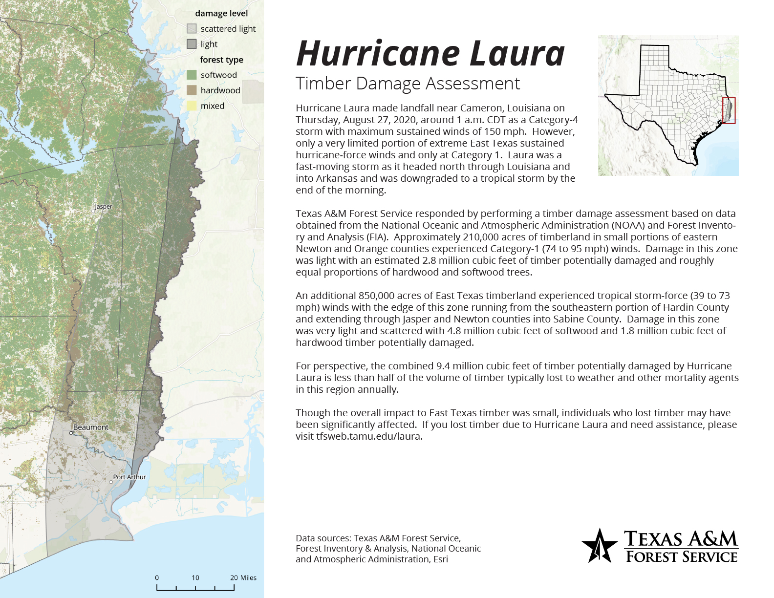
Hurricane Laura did not cause significant, widespread timber damage. We combined the wind speed data with Forest Inventory & Analysis plot data to estimate the potential amount of timber damaged or affected.
[Click to enlarge]
Though overall impact was minimal, individual landowners may have experienced significant loss. If your timber was damaged by Hurricane Laura and you need assistance, please visit our Hurricane Laura landowner assistance page.
Join the conversation!
+ Contact
Rebekah ZehnderGeospatial Analyst
200 Technology Way, Suite 1281
College Station, TX 77845
979-458-6630 office
979-458-6633 fax
rzehnder@tfs.tamu.edu