PREPARING FOR WILDFIRES
  • PREPARE FOR WILDFIRES: PROTECT YOUR COMMUNITY

    The expanding threat of wildfires to Texas communities is a result of the state’s ever changing land use, climate and population. Many Texas communities are within or are growing into the Wildland Urban Interface. The WUI is an area where flammable homes are mixed with flammable vegetation. 


    Community leaders such as city managers/planners, fire chiefs, emergency management coordinators and home owner associations, with the assistance of a local Texas A&M Forest Service WUI Coordinator, can implement community wildfire preparedness plans and programs to help your community withstand the next wildfire event.


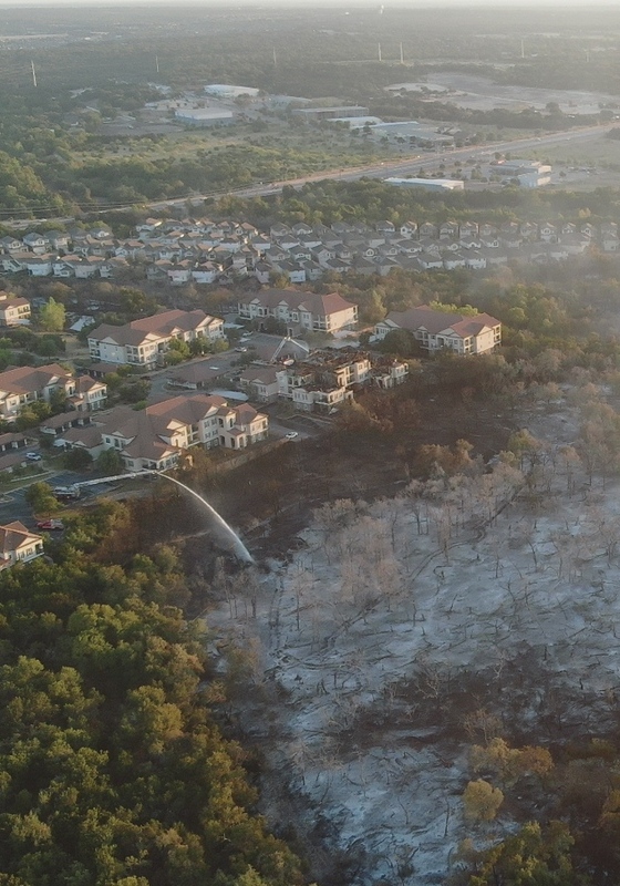
     Aerial view of a wildfire in a community with smoke throughout the sky


    Texas Communities Affected by Wildfire

     
    The question is not if a wildfire will occur within your community, it’s when. Over the past several decades, various Texas communities have lost numerous homes, businesses, commercial crops, livestock and human lives. Below are just some of the communities affected by past wildfires.
     
    • 1996: The Poolville Fire in North Texas, about 35 miles northwest of Fort Worth, resulted in the loss of 65 homes and 52 injuries. 
    • 2005: The Cross Plains Fire (PDF, 5MB) on the northern plains of Texas spread rapidly destroying 85 homes and causing two fatalities.
    • The historic 2011 Wildfire Season (PDF, 38MB) affected every corner of Texas. The Bastrop Complex Fire in Central Texas is the most destructive in Texas history with 1,660 homes lost and two fatalities. 
    • 2011: The Bear Creek Fire of Northeast Texas, the largest wildfire to ever occur in East Texas, destroyed 66 homes. The Riley Road Fire in Southeast Texas destroyed 73 homes. 
    • 2014: The Double Diamond Fire in the Texas Panhandle community of Fritch, 30 miles north of Amarillo, was ravaged by a wildfire that destroyed 225 homes in 14 hours.
     

    Protecting Your Community

     
    Wildfires do not need to be tens of thousands of acres to threaten your community. A wildfire of 100 acres or less can be just as destructive as a large wildfire. The Steiner Ranch Fire (2011) was only 125 acres, but destroyed 20 homes in Travis County. 
     
    Fortunately, your local Texas A&M Forest Service WUI Coordinator can work with your community to establish a suitable Community Wildfire Protection Plan (PDF, 22MB) or implement wildfire preparedness programs like "Ready, Set, Go!" and Firewise Communities
     
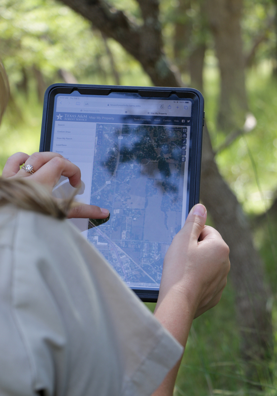
    WUI Coordinators can also help train community leaders to complete wildfire risk assessments and use the Texas Wildfire Risk Assessment Portal to reach a community’s wildfire preparedness goals.


     + Community Wildfire Protection Plan

    Community Wildfire Protection Plans (CWPPs) are a collaborative approach to wildland fire protection and mitigation.  A plan can be as simple or complex as the needs of the community dictate.  CWPPs are authorized by the Healthy Reforestation Act, signed into law in 2003.

    A CWPP can be used to identify high-risk WUI areas – where homes and businesses meet surrounding forests and fields.  The plan also can serve as an opportunity to target potential fuels reduction projects, training needs and prevention strategies.

    When developing a CWPP, WUI Coordinators along with community leaders work to:


    • Identify projects to reduce ignition sources around structures
    • Address treatment of structural ignitability
    • Identify local capacity building and training needs
    • Promote wildfire awareness programs


    A CWPP can be completed at the county or community level. Review the Leader's Guide and CWPP Guide for help creating an effective plan to reduce the risk of wildfire, home loss and provide for the safety of residents and firefighters.
    Bastrop CWPP

    Decatur CWPP


    View examples of completed CWPPs below:

     Amarillo CWPPBryan CWPPCity of Dallas CWPP
     Denton County CWPP Helotes CWPP Marble Falls CWPP


    Completed CWPPs May 2020


    Risk Assessment Results in HelotesHelotes Map


     + “Ready, Set, Go!”

    The International Association of Fire Chiefs launched the "Ready, Set, Go!" program nationally in 2011. Texas is very active with nearly 400 members. 

     
    “Ready, Set, Go!” is administered at the fire department level. The program helps your community learn how to protect homes ahead of time, stay abreast of current fire dangers and evacuate safely if a wildfire is bearing down on your community. It's based on a three-prong approach:  


    • Ready: Your home and family should be ready long before a wildfire ignites. Creating defensible space through proper landscaping techniques (PDF, 13MB) and using fire resistant building materials (PDF, 2MB) designed to withstand a wildfire are part of this step.
    • Set: When a wildfire is headed your way, it’s time to start preparing to leave. Alert your family and friends. Stay tuned to news reports. Grab your emergency kit, and be ready to head out at a moment’s notice. Make sure you know where you're going and what you're taking with you. The American Red Cross can provide shelter and basic necessities during a disaster and can help you get back on your feet after it's over.
    • Go! Once the fire is bearing down on you, there is often nothing you can do but get out of its way. At this point, it’s time to go!


    Don't wait. Evacuate early and you're more likely to avoid being caught in traffic jams or worse—trapped by smoke and fire.
     
    Map of Texas counties with at least one Ready, Set, Go!
     
    Don’t wait! Create your family’s “Ready, Set, Go!” Wildfire Action Plan today!
     
    Contact your local WUI Coordinator to register your fire department with “Ready, Set, Go!”


     + Firewise USA® Program
    NFPA’s Firewise USA® program teaches people how to adapt to living with wildfire and encourages neighbors to work together and take action now to prevent losses. Sponsored by the National Fire Protection Association. The Firewise USA® Recognition Program is aimed at small communities, community associations and master planned communities. The goal is to assess the wildfire risk and create a network of cooperating homeowners and organizations within a community and a community’s fire department. Texas is home to over 90 Firewise USA® Sites.


    Being recognized as a Firewise USA® Site requires that the community has an on-going commitment toward mitigating wildfire hazards within their community.


    To become a Nationally recognized site,  NFPA requires the following steps must be completed:


    • Wildfire Risk Assessment: Enlist a WUI Coordinator to complete a wildfire risk assessment and create a plan that identifies agreed-upon achievable solutions to be implemented by the community.
    • Board/Committee: Form a board/committee of residents and other stakeholders to develop a multi-year Action Plan based on the assessment. The board oversees the annual renewal requirements.
    • Action Plans: are a prioritized list of risk reduction projects developed by the board/committee from the risk assessment to help reduce wildfire risk.
    • Educational Outreach: each participating site is required to have a minimum of one wildfire risk reduction education event, or related activity annually. 
    • Wildfire Risk reduction investment: at a minimum, each site is required to invest the equivalent of one volunteer hour per dwelling unit in risk reduction actions annually.
    • Application: applicants begin the overall process by creating a site profile at: Portal.firewise.org. The application is eligible for submission when the overall criteria is completed.


    Additional requirements from the Texas A&M Forest Service:


    • Provide a boundary map of the site. Texas A&M Forest Service will convert to a PDF format and also create GIS Shape files
    • Provide Name and contact information for the Fire Department that provides protection for the site.


    See this NFPA Fact Sheet on Becoming a Recognized Firewise Community.

    Two men stacking firewood while other people work in the woods surrounding them.

    Texas map of counties with at least one Firewise USA community.

    To learn more about the Firewise Communities/USA Recognition Program, contact your local WUI Coordinator today.

     
     + Texas Wildfire Education Sites

    Texas A&M Forest Service believes that wildfire risk reduction work is something everyone can accomplish, if they are just taught how. The Texas Wildfire Education Sites program, started in 2019, encourages parks, camps, schools and other public locations to show off how they are becoming more fire adapted. Becoming a recognized site will help create safer communities across the state and support the Texas A&M Forest Service’s goal to reach a greater number of Texas citizens with wildfire safety information. Texas Wildfire Education Sites will promote wildfire preparedness and illustrate fire resilient principles in action.


    By becoming a Texas Wildfire Education Site, you will join the Texas A&M Forest Service in spreading knowledge about protecting homes, communities and our natural areas.


    To become a recognized Site, the following minimum requirements must be met:

    • Form a board of a minimum of 2 educators/site leaders
    • Schedule mitigation and prevention training and a risk assessment with a local WUI Coordinator
    • Create an action plan detailing future mitigation goals, maintenance and educational outreach
    • Complete and maintain property mitigation: must have fire resilient landscaping demonstration site
    • Submit application and documentation to Texas Wildfire Education Peer Review Group


    If you are interested in learning more about the Texas Wildfire Education Site program, please contact Kari Hines at khines@tfs.tamu.edu, or your local Wildland Urban Interface Coordinator.

     + Fire Adapted Communities

    Wildfires will occur where people live—it’s not if, but when. And when a community hasn’t prepared, the economic, social and environmental consequences can be far-reaching. Taking the right steps in advance can minimize damage to homes and property, increase public safety, protect infrastructure and businesses, save millions of dollars and ensure future tourism and local recreation opportunities.

    Implementing a Community Wildfire Protection Plan, or a program like "Ready, Set, Go!" and Firewise Communities/USA in your community is the best way for your community to become fire adapted.

    To learn more about joining the Fire Adapted Communities initiative, contact your local Wildland Urban Interface Coordinator today.

     + Community Wildfire Defense Grant

    The Community Wildfire Defense Grant offers financial assistance to at-risk local communities with planning for and mitigating against the risk of catastrophic wildfire.  This program is authorized in Public Law 117-58, "An Act to authorize funds for Federal-aid highways, highway safety programs, and transit programs, and for other purposes", commonly referred to as the Infrastructure Investment and Jobs Act.


    There are two primary objectives for which the grant will provide funding: The development and revision of Community Wildfire Protection Plans (CWPP), and the implementation of projects described in a CWPP that is less than ten years old.  The Act prioritizes at-risk communities that are in an area identified as having high or very high wildfire hazard potential, are low-income, and/or have been impacted by a severe disaster.


    Entities eligible to apply for funding under the Community Wildfire Defense Grant include:


    • Local governments representing communities located in an area with a risk of wildfires
    • Native American tribes
    • Non-profit organizations, including homeowner associations that assist such communities
    • State forestry agencies


    Eligible applicants may apply for grant funding for a project proposal to be conducted on local government, state government, Tribal, HOA, and privately owned lands, provided the project proposal directly reduces wildfire risk to a community.


    There is no minimum federal funding limit for projects under the Community Wildfire Defense Grant.  The maximum amount of funding awarded to any one community or Tribe via this competitive grant is:


    • $250,000 for the creation or updating of a Community Wildfire Protection Plan
    • $10 million for projects described within a Community Wildfire Protection Plan less than ten years old


    Cost-share is required for all applications funded under the CWDG Program.  The cost share rates for this program are:


    • Not less that 10 percent for development or revision of a CWPP
    • Not less than 25 percent for project implementation as described in a CWPP that is not more than 10 years old


    The closing date for applications is currently October 7th, 2022.


    Learn more about the Community Wildfire Defense Grant and how to apply here:

    https://www.fs.usda.gov/managing-land/fire/grants


    Learn more about your community's wildfire risk: https://texaswildfirerisk.com/


    Texas A&M Forest Service Contacts:

    Community Wildfire Defense Grant Coordination Group, CWDG@tfs.tamu.edu


     + Texas Wildfire Risk Assessment Portal

    The Texas Wildfire Risk Assessment Portal is an online, user-friendly, statewide planning tool that provides reference information, maps, reports and statistics for community leaders in regards for wildfire planning and mitigation needs. TxWRAP provides information on the following topics:


    Wildfire Risk Themes

    • Wildland Urban Interface (WUI)
    • Pine Plantation Response Index
    • WUI Response Index
    • Where People Live
    • Community Protection Zones
    • Wildfire Threat
    • Wildfire Ignition Density


    Landscape Characteristics

    • Surface Fuels
    • Vegetation
    • Pine Age
    • Pine Plantations
    • Dozer Operability Rating
    • Percent Slope
    • Landforms
     

    Wildfire Behavior Outputs

    • Characteristic Fire Intensity Scale
    • Characteristic Rate of Spread
    • Characteristic Flame Length
    • Fire Type- Extreme


    Historical Wildfire Occurrence

    • Wildfire Ignitions
    • Large Wildfires
    • Wildfire Case Studies


    TxWRAP depiction of Travis County WUI

    TxWRAP has the ability to produce an informative output summary of maps, text, tables and graphs for your county, community or fire department response area. The information can be included in your Community Wildfire Protection Plan (PDF, 22MB) or other wildfire mitigation plans. 

    To learn more about using TxWRAP, please contact your local WUI Coordinator.
    TxWRAP Summary Output